Ian Battersby finds a tour of the Cadair Idris Lakes – LLyn Aran, Llyn y Gadair and Llyn Cau – covers most of its cliffs, too.
This walk was born from a yearning to call on Cadair Idris – so named for the seat of a giant called Idris – by a more unfamiliar route. Thus, an itinerary linking all its llyns with the summit became a tantalizing tease. It’s made possible by vast tracts of Open Access Land that cover the lesser slopes. Cadair Idris is colossal and stands on three flanks of cliffs. Coupled with its isolated, stand-out position; it draws in mountain devotees from far and wide. There are no rights of way that traverse beneath its northern crags, and tussocks, with an awkward fence crossing, will deter all but the most foolhardy. But to gaze with wonder up at these incredible heights is a worthy aim. The lakes grow in beauty in turn, but although they were the initial justification for the venture, it was the company of nearly all the crags of Cadair that left the most evocative impression. A local legend says anyone who spends the night on Cadair Idris should awake either ‘a poet or a madman’. Why not include an overight camp and test the theory for yourself?
Cadair Idris via LLyn Aran & Llyn y Gadair: route description
START/FINISH: Large layby on A487 east of Cadair Idris; SH753136 | MAPS: OS Explorer OL23 (1:25k), OS Landranger 124 (1:50k), Harvey British Mountain Map Snowdonia South De Eryri (1:40k) | DISTANCE: 16.3km / 10.1 miles | ASCENT: 1,015m / 3,330ft | DURATION: 6.5 hours
1. SH753136: On the opposite side of the A487 to the layby cross a ladder stile and follow the permissive path NE alongside the road to a second ladder stile. Re-cross the road to a quarry entrance and a stile from where the permissive path continues NE to another stile. Cross this and pick up a grassy track by a gate. Follow this N and ford a stream with stepping stones by a barn. Follow the yellow diversion arrow left upstream to a ladder stile. A second arrow points half right but rather continue N, heading uphill, past a broken yellow marker post. The OS Explorer map shows the bridleway to the right of a double walled track, which is now overgrown. Keep left of this track and with the wall on your right climb NW through a wall gap, and later a metal gate, to reach a smaller, wooden walker’s gate.
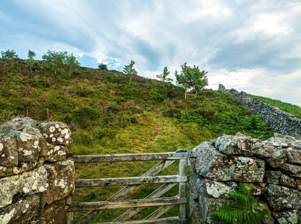
Walkers gate at SH750154. Credit: Ian Battersby
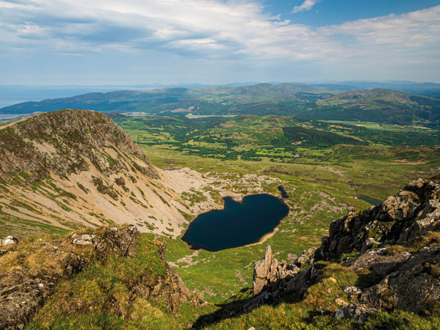
2. SH750154: Now climb west across trackless Access Land, passing a red topped gas line marker post to join an indistinct public footpath. Follow this SW through gaps in a wall, a metal gate, and two ladder stiles. Now, having passed the walls, climb SW across tussocks to reach LLyn Aran hiding in a hollow beneath Mynydd Moel. Cross the outflow and follow a sheep track NW to a prominent boulder. Cross an awkward fence and climb W to around 530m, then contour NW to a fence junction. Go through the metal gate and follow the fence W, crossing a ladder stile, to reach the point where the fence turns N. Drop W to Llyn Gafr.

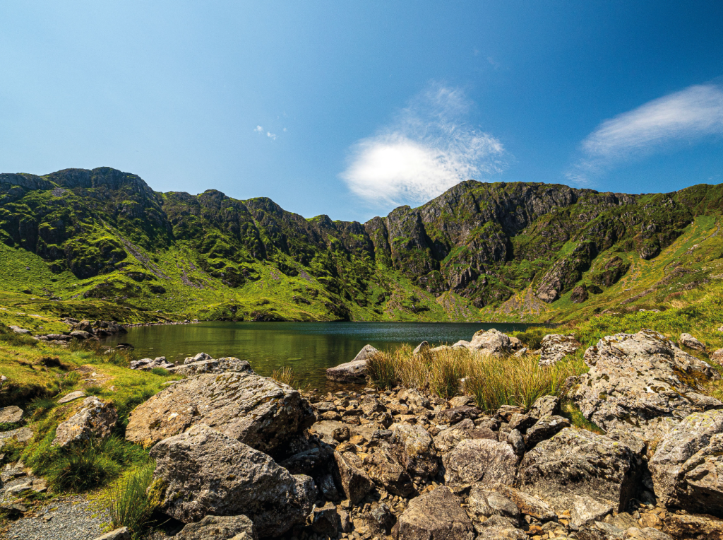
Cyfrwy from Llyn y Gadair. Credit: Ian Battersby
3. SH709142: Follow the Cadair Idris path climbing SW to Llyn y Gadair, where the path skirts the NE shore, heading SE towards a wide, scree filled gully with a small ridge on the left. Climb either of these very steeply heading SE to reach the Cadair Idris ridge, where the path turns SW for the shelter and trig point on Penygadair.
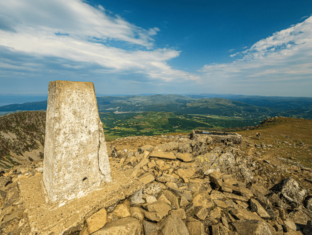
Penygadair summit. Credit: Ian Battersby
4. SH711130: Follow the bridleway W along the northern edge for outstanding views back down to Llyn y Gadair, then cut S to join the path heading S to arrive at the col at Craig Gau.
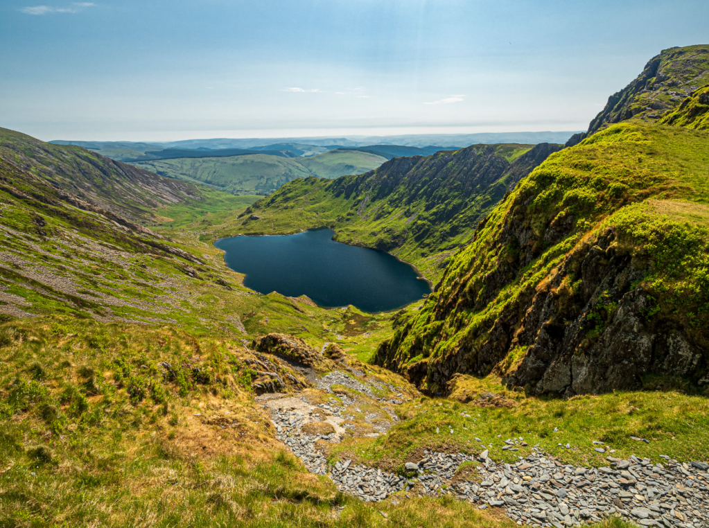
Direct descent to Llyn Cau. Credit: Ian Battersby
5. SH709125: Turn left, heading SE down a very sheer, rough path of slate scree, turning scrambly over the steepest sections. Variations are available, but towards the bottom pick up a path heading E along the northern shore of Llyn Cau. At the end of the lake the path turns S along the eastern shore, before turning E to join the main path following Nant Cadair. Follow this good path E then S, down to a walker’s gate at 240m.
Llyn Cau. Credit: Ian Battersby
6. SH727119: Through the gate the path drops suddenly through woods by waterfalls rumbling on the left. Steps drop to another gate. Turn left along a track heading NE past the tea shop to a gate. Follow the track SE through the nature reserve and past the car park to reach the lane entrance after a gate. Continue SE to the A487. Follow the A487 with care heading NE to reach the entrance to Cwmrhwyddfor Campsite on the left after 500m.
7. SH737118: Turn left into the farm entrance and pick up the stony track heading NE downhill from the road. Gates lead past the campsite and the track turns grassy, climbing to return to the road at 290m after a mile or so. Continue by road for 200m to return to the initial layby
Further information
PUBLIC TRANSPORT: Bus T2; Traws Cymru
TOURIST INFORMATION: Betws-y-Coed, 01690 710426