

Ian Battersby uncovers the power of a mountain with this walk up Ben Cruachan.
Ben Cruachan storms up from woods, lochs and glens to join an assorted bunch of near neighbours, whose pointed peaks pierce the skies of an undulating ridge, and Cruachan, at 1,126m, reigns supreme. Energy is needed to power up surging gradients further defended by an army of trees and tangled undergrowth. But once on top, with work done in a flash, enjoy the scene, and gloat in the downhill dash, converting potential energy gains into smiles.
While Cruachan is happy to display a wondrous landscape from on high, it is more reluctant to give away the resourceful secret buried within. Also known as the hollow mountain, there are few clues to give away its adopted role. There is a reservoir dam, and power lines make the climb, but hidden inside the belly of the mountain, a power station stands by, with water acting as fuel. In parallel to climbing the peak, the water here is powered up to the reservoir in quiet morning hours, and there it rests, awaiting demand and the fated downward drive through a spin of turbines there to change potential energy gained into electrical power.
Ben Cruachan: route description
START/FINISH: Falls of Cruachan Railway Station; NN080267 | MAPS: OS Explorer OL377 (1:25k), OS Landranger 50 (1:50k) | DISTANCE: 11km / 6.8 miles | ASCENT: 1,241m / 4,072ft | DURATION: 5.25 hours
1. NN080267: Head up steps to the Falls of Cruachan railway station and go through the metal gate at the top signposted to Ben Cruachan. Go under the railway and turn left up yellow painted steps. Leave the steps where they bend right and continue heading NW along a path that cuts through woods diagonally up the slope towards Allt Cruachan. Once near the stream, whose cascades rumble invisibly among the trees, the path turns N, climbing directly over roots and rocks and weaving between branches bracken. The going is steep but cool amid damp, luxuriant foliage. Exit the woods using a stile at 250m. The path continues N up the mountainside, still right of the beck with waterfalls now on show, before arriving at a sealed lane and bridge.
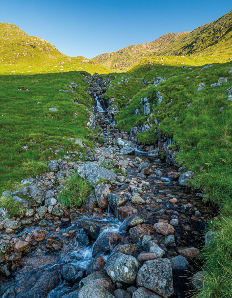
Waterfalls in stream below Coire Dearg. Credit: Ian Battersby
2. NN081277: Cross the bridge and follow the lane up to the foot of the dam. Grassy steps climb W to the end of the dam, where a metal staircase climbs to the top of the dam, with fabulous views of the reservoir and the pyramidal summit of Ben Cruachan on the left. Go through the metal gate at the western end of the dam and follow the stony track SW but soon turning N alongside Cruachan Reservoir. Cross a metal railed bridge with a small wind generator noting the slope on the left where the return route comes down. At the end of the reservoir, just before the track reaches a tunnel entrance, look for a minor path heading W by the stream flowing from Coire Dearg.

Cruachan Reservoir. Credit: Ian Battersby
3. NN082294: Head WNW up this path, following the N bank of the stream. The path is reasonable over fairly easy ground at first, with the picture of Cruachan Reservoir nestled below its ring of mountains growing in stature, all the while getting deeper into the Coire Dearg. Escape comes when the path turns W at around 650m with 200m of steep ascent ending at a small pool nestled atop Bealach an Lochain.
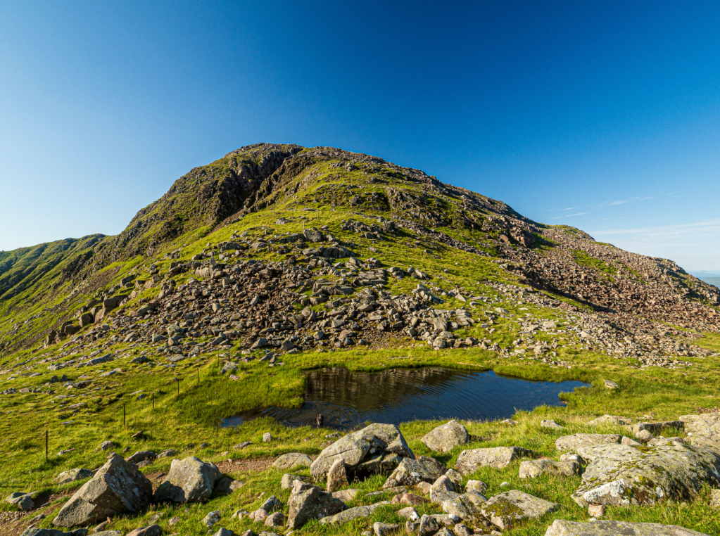
Bealach an Lochain. Credit: Ian Battersby
4. NN070298: The final climb is a no messing direct ascent N up the south ridge of Ben Cruachan. The going gets rockier with altitude gained, and becomes quite blocky over the final 100m of climbing, where the path frays among boulders and slabs, then suddenly the view opens magnificently to the N at the summit cairn and broken trig point (1126m).

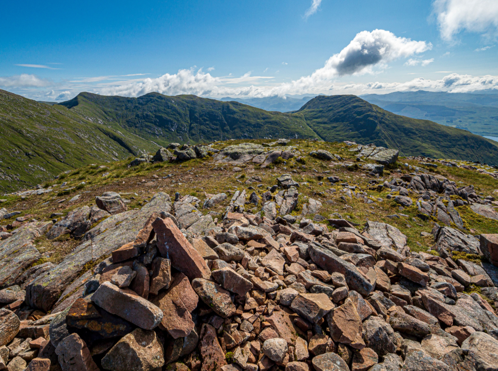
Meall Cuanail and Beinn a’ Bhùiridh from Ben Cruachan. Credit: Ian Battersby
5. NN070305: Retrace steps S to Bealach an Lochain, with Meall Cuanail, the next top, in view along the ridge. From the small pool climb S along a path that comes and goes in rough grass which once again gets progressively rocky, though not to the same extent as Cruachan. A cairn marks the summit (918m).
Beinn a’ Bhùiridh from Meall Cuanail. Credit: Ian Battersby
6. NN069296: The descent follows a ridge SE, soon turning E, with old metal fence posts a convenient guide. At 870m follow the posts SSE down to 770m, where they turn S. Follow them down to 600m. Now the severity of the ground on the left has eased it is possible to descend over trackless terrain, taking the line of least resistance down to the bridge and wind turbine that was passed earlier by the Reservoir. Turn right along the track to the dam. Now either retrace steps to return to the bridge over Allt Cruachan, or cross the dam and follow a sealed lane SE, turning SSW and dropping down to a junction at 340m. Turn right down the hairpins to the bridge. Retrace steps S, dropping down to the stile into the woods, and steeply down through the trees to the station.
Further information
PUBLIC TRANSPORT: Trains from Oban and Glasgow (ScotRail); CityLink buses from Oban
TOURIST INFORMATION: Oban, 01631 563122
Walk more routes in Scotland, as mapped by our experts.


