
View all of Tenerife’s peaks from this mountain in the Cañadas border range
Tenerife’s third-highest mountain might only stand at 2,715 metres, but the climb up this jutting, cliff-like peak is almost as physically challenging and possibly more technical than the ascent of Mount Teide. Begin at the Parador complex – a tourist packed parking spot with a restaurant – and follow Sendero 4 southeast.
You’ll soon leave the crowds behind as you begin to climb, enjoying increasingly open views towards Pico Viejo, El Teide and the distant island of La Palma. The tricky part comes when the path reaches Degollada de Ucanca at 2,414 metres and begins the steep slog up to the summit, eventually becoming a bouldery scramble that hovers around grade 1 territory. An added risk of rockfall from the peak above means this isn’t a route to be taken lightly, particularly as the ascent is steep and treacherous underfoot.
A selection of scenic highlights is saved for the end of the day, with the path circumnavigating an outcrop of ochre-coloured buttresses and pinnacles. It takes around five hours to complete the full 10km circuit – and if you’re after something a little more epic then there’s always the option of bypassing the summit tick and continuing on from Degollada de Ucanca to Vilaflor for a long day of walking.
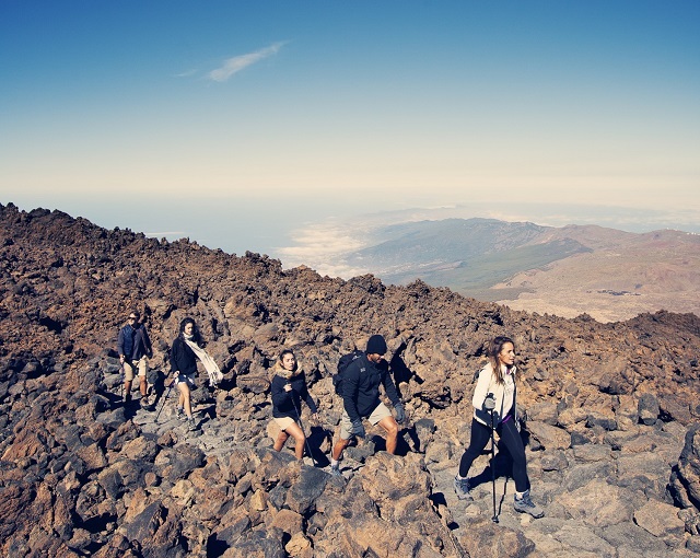