Britain’s uplands are littered with ancient historical detritus. Look at any heavily contoured map and you’re almost certain to spot indicators of settlements, old cairns, stone circles, tumuli, Roman roads and more. Even more excitingly, new sites are still being discovered on strolls through history – six of which we round up below. “If you’re walking in certain areas, there’s a genuine chance that you might be able to spot a stone circle that nobody knows about,” says James Canton, author of Grounded: A Journey into the Landscape of Our Ancestors.
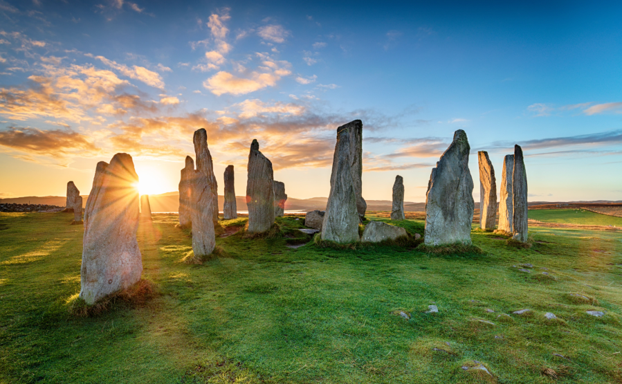
Main image: The Callanish sgtone circle on the Isle of Lewis | Credit: Helen Hotson / Shutterstock
“Only recently a new site was discovered near Matlock in Derbyshire.” Not many of us will be lucky enough to make a momentous archaeological discovery while out hiking, but we can all learn to recognise the signs of ancient human occupation, industry and worship. And seeing the traces of those who walked before us can make our modern-day explorations richer.

Research and planning
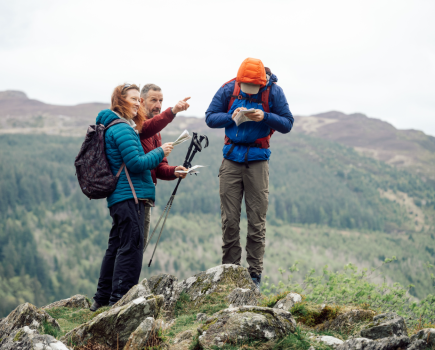
Browsing Ordnance Survey maps will give you a good historical overview of an area (see below for signs to look out for), but for detailed information it’s worth searching locally. James gets much of his insight from books and pamphlets written by knowledgeable locals, which he often tracks down in smaller bookshops. “Independent book stores are the best places to start,” he says. “If you ask the people in there then often they’ll guide you to a local who’s created a map of historical walks. I’ve got A Wee Guide to Prehistoric Scotland, for example, which I picked up for £2.50 in a book shop on Colonsay.”
He also recommends the Shire Archaeology series. “General books and websites tend to cover the big sites, but it’s those local books that will pull out the subtleties of the landscape. What’s wonderful is when you end up in a field and you know that what you’re looking at nobody has seen in ages.”
Word of mouth is another good way to identify lesser-known historical features. Local guides and enthusiasts can help, and there are national clubs as well – such as The Stone Club – which run field trips, tours and festivals for amateur archaeologists.
Read the landscape
Sometimes, the landscape itself can point you in the right direction. Neolithic barrows and hillforts were often placed in high areas with particularly wide visibility. Flat, raised areas near the confluence of rivers lent themselves to settlements. And fords have always been important to humans. “If it’s the easiest place to cross the water, that will probably have been the case for thousands of years,” says James. The recognition of the continuity of being human can be extremely powerful, and you can trace that continuity simply by having an awareness of where the sacred places are going to be. Water crossings are the most obvious.”
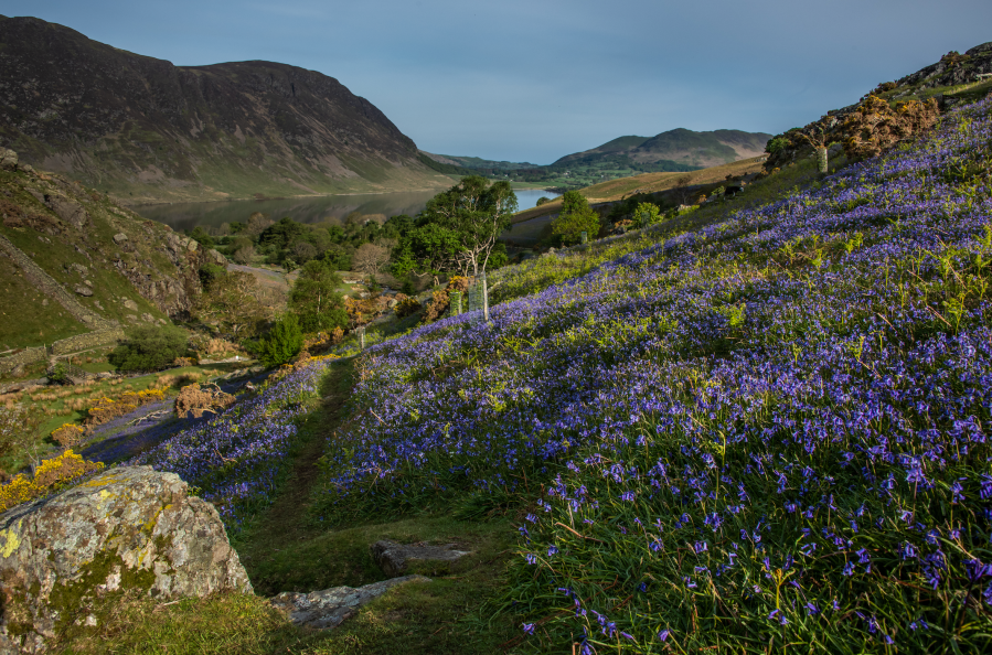
Vegetation can hint at ancient human activity as well. Archaeologists look for differential growth in crops or grass – parchmarks in dry weather can be a sign of hidden ditches or foundations. Indicator species such as wild service trees and bluebells can mark patches of ancient woodland. And some people think that spindle, a pink-flowering shrub, was spread by the feet of people walking old paths and roads. “If you walk these paths in June and see spindle’s beautiful pink flowers, it’s nice to think they were planted by ancient boots,” says James.
But the best time to make archaeological discoveries, he adds, is in winter, when dying vegetation can reveal hidden secrets of the landscape. “Winter is a good time to look, when there are fewer grasses in the way. Keep an eye out for the patterns of the stones. At the site that’s recently been discovered near Matlock, there was already one large monolith there but then archaeologists found a number of other stones around that site. That’s the kind of thing that, as a walker, you can sometimes rediscover.”
Follow the old ways
Walking an ancient route is one of the best ways to attune your archaeological antennae. Some of these routes are now officially designated Long Distance Paths – such as Hadrian’s Wall Path, The Ridgeway National Trail and Offa’s Dyke Path – while others are old corpse roads, shortcuts to market or ‘hollow ways’ best discovered through local knowledge. They tend to link ancient settlements or sites of importance, and many are a rich source of archaeological finds.
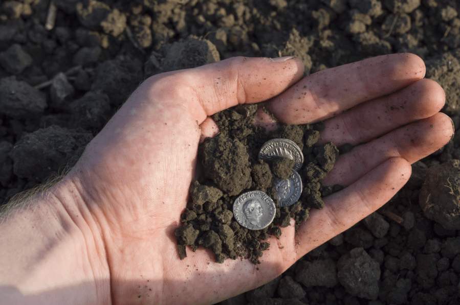
“I found a Roman key with three flames coming out of it while searching for a section of a Roman road,” says James. “And in a village near to where I live, they’ve found coins from a certain period all the way along a local greenway.”
If you do discover anything interesting, the first step is to note the location you found it in and report it to the local county finds liaison officer. As well as recording it for posterity, they will often help you discover more about its age and origin. You might even get to keep it, although that’s dependent on its value and importance. Important archaeological finds by walkers include a Bronze Age burial cist on Dartmoor, Iron Age gold jewellery in Hampshire and a ceremonial dagger in Norfolk. So who knows? It could be you…
What’s in a name?
The name of a hill, a valley or a village can often give you a clue to its origins. ‘Howe’ or ‘low’ indicates a burial mound. Ancient settlements often have names that end in ‘field, ‘worth’, ‘ton’ or ‘ham’. And ‘bury’, ‘caster’ and ‘chester’ all designate fortified Roman sites.
6 strolls through history
Take a stroll through history with visits to these upland archaeology hotspots, from Scotland to the Lakes, the South of England and beyond.
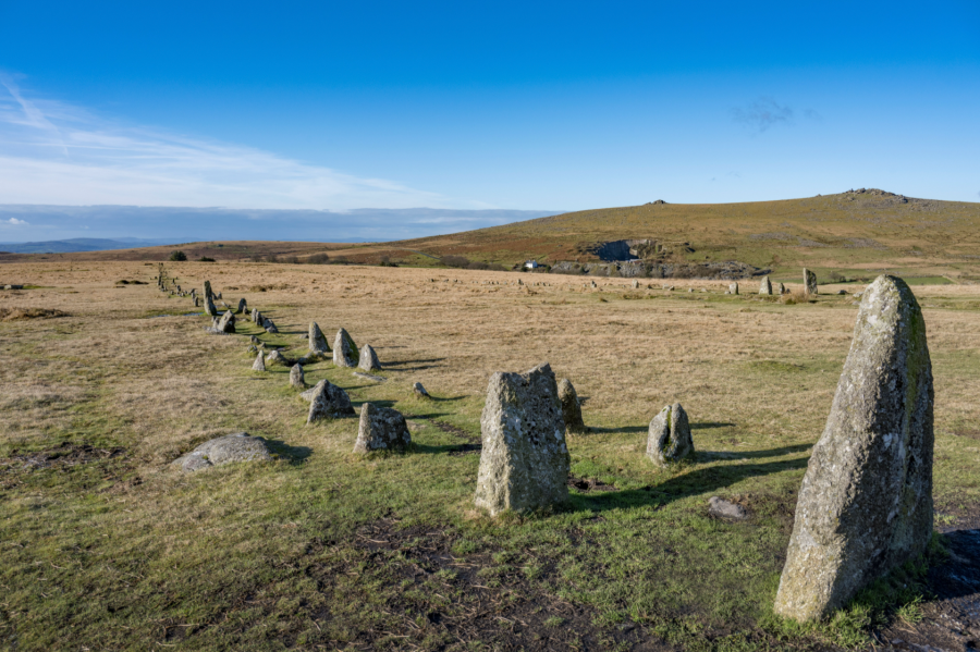
Stall Moor, Dartmoor
Home to the world’s longest stone row, which runs for 2.1 miles through the remote heart of the moor. To follow the row end to end on a stroll through history, you’ll need to brave a precarious crossing of the River Erme. Better to explore its most visually spectacular southerly strip on a circular from Ivybridge (wild camp optional).
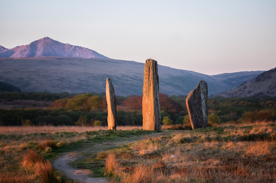
Machrie Moor, Arran
The enormous standing stones on Machrie Moor date to around 1800BC, but archaeologists think this stunning site was occupied even earlier. It’s a relatively easy stroll up from signed parking on the A841, and the view of Goatfell in the distance adds to the atmosphere.
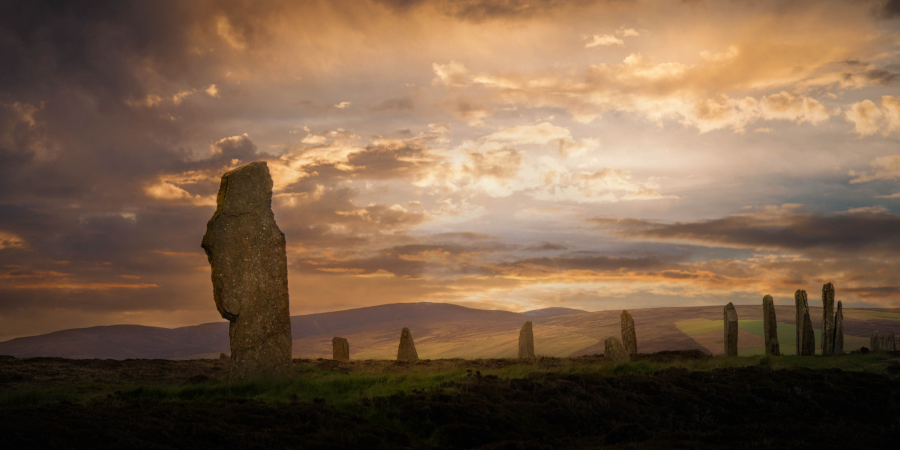
Brodgar Peninsula, Orkney
Mainland Orkney is prehistoric heaven, home to a giant ancient ceremonial complex that includes ditches, burial mounds and standing stones. You can link most of the sites on a peninsula ramble, but it’s also worth extending your visit to see nearby Maeshowe (a 5,000-year-old tomb) and the prehistoric village of Skara Brae.
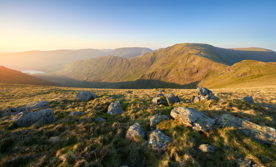
High Street, Lake District
The highest Roman road in Britain links Ambleside with Brougham fort near Penrith on one of the finest strolls through history in England. It’s an appealing long-distance hike of nearly 22 miles, and you can still see some of the original kerb stones and metalling in some areas.
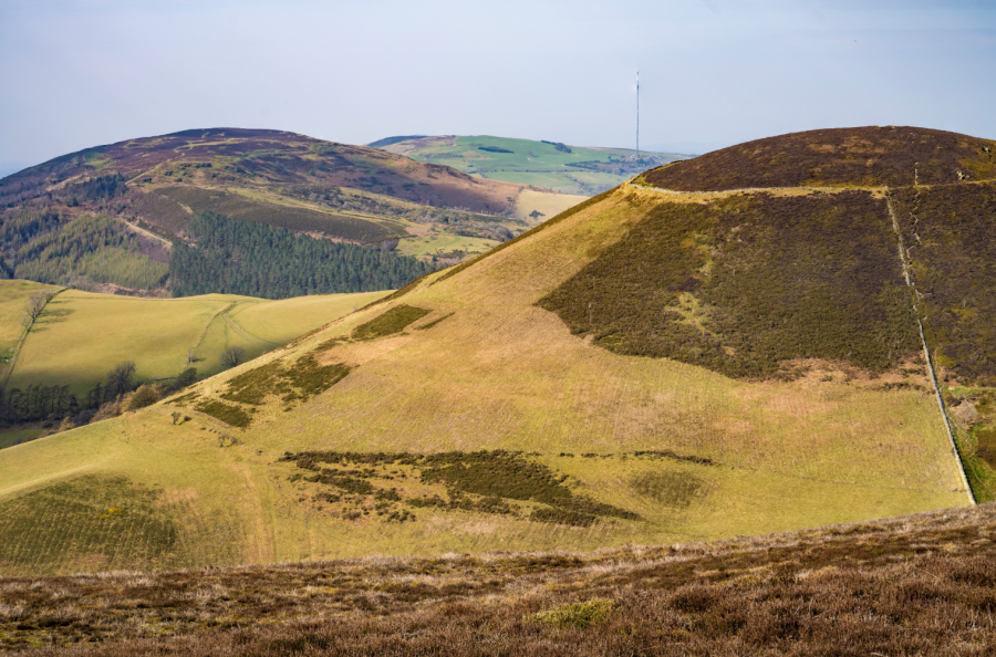
Penycloddiau, Clwydian Range
Climb this Flintshire Marilyn to explore one of the largest and best-preserved hill forts in Wales. You’ll see evidence of ditches, ramparts, roundhouses and central ponds in what was once an enclosed 21-hectare settlement.
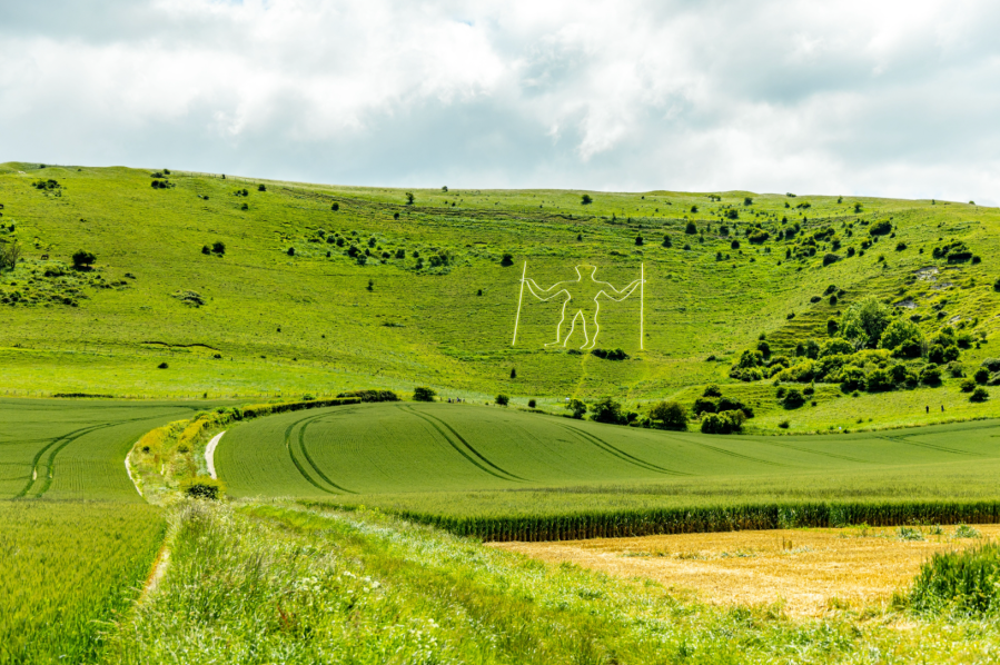
Wilmington, South Downs
The eastern edge of the South Downs was clearly a hotspot of activity in Neolithic times – on the ridge that stretches between Firle Beacon and the Long Man of Wilmington, you can’t move for barrows and workings on strolls through history here. And then there’s the Long Man itself; an enigmatic chalk figure whose origins and meaning have baffled archaeologists for centuries.
Grounded: A Journey into the Landscapes of Our Ancestors by James Canton is published by Canongate.