
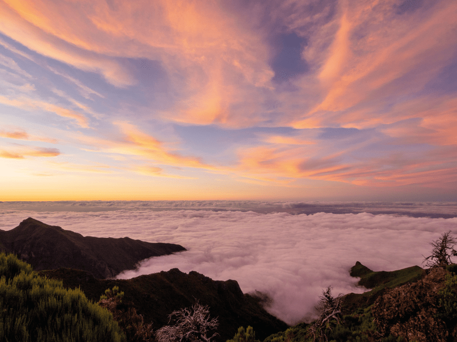
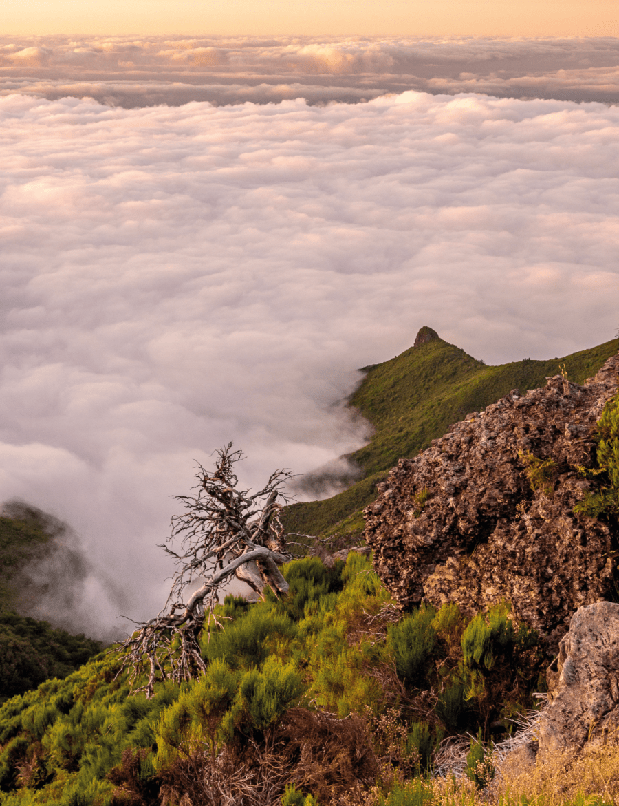
Main image: An ocean of cloud over the Atlantic at sunset on the Madeira Island Ultra Trail | Credit: Ian Battersby
Madeira – Portuguese for wood – is an appropriate name for a profoundly forested island, but more than that – it not a huge leap to get from wood to lumber, and the alternative definition: to move in a slow, heavy, awkward way. That suited our journey perfectly. We had been moving so slowly, heavily and awkwardly for days now.
Ryan, my 19-year-old son, fancied a physical challenge. Josh, his older brother (25) was curious, and the old man seemed welcome too. A rushed exchange quickly settled on Madeira, but I knew Madeiran mapping to be short on detail. Research into long distance trails uncovered the Madeira Island Ultra Trail (MIUT), as well as a GPX download to help keep us on track over its 115km and 7100m of ascent.

I also learnt that true wild camping isn’t allowed, and news of fines and rangers to enforce them led me to look at alternatives. I tried the “wild camping” sites permit system but attempting to calculate our pace over demanding terrain in advance proved impossible, and using this free service impractical. We hoped to evade local bureaucracy by bivouacking – pitching late, rising early, and leaving no trace as usual. The map suggested enough nearby villages, so we relinquished dried food and cooking gear.
Steep and sweltering
With risks weighed and decisions made we arrived at Porto Moniz, staring up at a sheer start, while feeding up at the local mini market. I was glad of the GPX trail, which I followed on OS Maps’ base mapping, backed up with paper 1:40,000 Madeira Tour and Trail map, which proved useless for detail. Our first climb under high noon sun was a cruel intro to the trail but reaching only 400m this really was just an appetizer.
Even so, sweat poured and lungs heaved up past the humble smallholdings that dotted the route. At the top our sweltering effort was cruelly forsaken as the route plunged straight back down, down, down to a cove of incredible rock stacks towering up from deep blue Atlantic waves. There, we met a solo backpacker who had just finished his backpack. He radiated knowledge, and reassured – he’d seen no one watching for wild campers.
Refreshed, we scrambled back into longed-for forest shade, where Madeira lived up to its name for the rest of the day. Lush foliage tempered stifling heat as legs toiled up a perpetual gradient beneath packs laden with water taken from village taps. This sparsely mapped land posed questions without answers. Where would we find food, water and a good place to camp? Will we even make it? I put these questions aside, confident that things generally work out.
But what of the boys? I had less concern for Ryan. His military background had forced him into more discomfort than I ever experienced, but would he rein in youthful enthusiasm enough to pace himself? Josh walked plenty as a kid, but though he excels at mountain biking his walking is limited to occasional day rambles. Now he was in difficult terrain, with no break from the vertical toil, sat on his weighty pack, with a determined expression staring into leafy space. We pressed on, then rested, and repeated, the dense woods offering few distractions. There was only the upward here-and-now, and sly doubts teasing at the edges of my mind.
A wooded paradise
We entered ancient laurel forest, where lichen hung like ragged cobwebs from twisted, interlocking limbs that cast a mesmerising spell. This is the greatest laurisilva in the world. Boasting World Heritage status, its 40-million-year-old subtropical ecosystem endures, mostly unscathed and supported by moist northerly trade winds. Finally, the gradient abated and we entered an isolated glade of closely grazed grass with picnic table, barbeque area and blue sky above. We rested, scouted the area, smiled and relaxed. This being the only flat ground since the coast, we borrowed it for the night as dipping sun turned magical evergreen laurels to gold.

Trade winds ushered in mist overnight. We munched on breakfast bars, then waited out a steady downpour before easing out of inclining forest into a sun drenched, mystical grassland, colonised by giant, primordial laurel trees at Fanal. Now, although the climbing had lessened, all was not well with Ry. An old shoulder injury had returned, and he looked very gloomy. Josh came to the fore and fashioned a chest strap. It didn’t look much, but it allowed my youngest to press on, alongside wooded voids that plunged through v-shaped gorges to the coast 1200m below. And 900m of precipitous descent was where the path was headed.
We studied the map, disbelieving, feeling compassion for the runners who sign up for this Ultra route, albeit more knowingly than us. We had water from Fanal, which I was guzzling to fend off a tenacious headache, but only trail snacks to sustain us. Dejected we paused. We could stay high, miss the drop, and find food on the Paul da Serra plateau, but what about our ultra-trail, and if we dropped where would we camp? An hour passed while we deliberated, with ever resourceful Josh scanning Google for suggested eateries.
Ultimately the challenge prevailed over the tempting call of common sense. Down down we went, not feeling entirely sane, not thinking of tomorrow’s climb. Back down through the laurel, lichen and ferns. Down impossibly steep paths and mossy steps, slipping, stumbling and sliding, balancing on poles, jarring shoulders, with a banging head and burning quads. Resting, not quite believing, then quickening down to make the restaurant before close. A banquet was enough reward for an illogical day, and locals advised us to find any field to camp in, so we did, and no one bothered the bold.
Jungle journey
We were at 300m and the map suggested sheer climbing without food to 1000m – or an off route descent to sea level and into Seixal for supplies. It seemed crazy, but we craved savoury sustenance over snacks. Replenished and restocked we climbed back up through the laurel, lichen and ferns, making joyful progress in the shade along an implausible line, protected from exposure by tall trees that hemmed us in. After 1000m of remarkable climbing the gradient eased – slightly.
We remained within a dense, congested forest and the fatigue began to tell. Water appeared on the map but not on the ground. Ryan set a determined pace. Forest gave way to bush and sun blazed thorny briar, which we scoured hopelessly for a camp while swallows whizzed within inches of our sweating brows. Another 200m climbed, then another hundred. Joy ebbed, humour struggled and died, doubts resurfaced. We drained the last drops of water and, though the land levelled, the distances extended. Josh slipped, jarring his back. He ushered me on. I sensed he wanted to deal with his demons alone. I drew level with Ryan at 1500m, where pine trees rescued us with another stunning camp replete with tables and barbeque chimneys. I shouted encouragement to a distant Josh, but his head didn’t lift, and he struggled in on his last legs. Then, a smile.
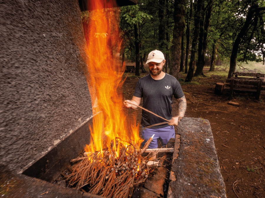
You expect tough, but you get Madeira. We washed, ate, lit a fire in the barbeque pit and washed again. Finally, sleep washed over the crew.
Levadas and Ferratas
The next days saw us deviating from the Madeira Island Ultra Trail. First a minor diversion that saved 200m of descent (and therefore re-ascent), justified in our minds by the extra 300m we had climbed from Seixal. We traced the line of a 15th century irrigation channel. The Levada Do Norte contoured through forest and two long tunnels to reach Encumeada at 900m. The first tunnel was around a kilometre long, with a narrow canal-style path to the side of fast flowing water. Crudely chiselled walls pushed us over the water and the roof forced our heads down, as we sloshed through puddles under torchlight towards a developing pinprick of liberating light.
Encumeada served up praiseworthy pizzas, and staff suggested camping at another picnic spot 300m down with more campers; some backpackers and others just up from the towns. There seemed no threat of fines.
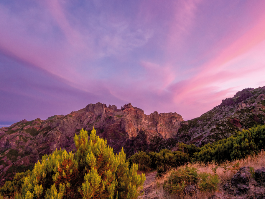
Unsurprisingly, the following day saw more ups (to 1200ms) and downs (to Curral das Freiras), and yet more ups… to Pico Ruivo, highest point of the island. The map suggested an easier ridgeline. We hoped that this wouldn’t be one of the notorious, machete demanding, overgrown routes – we only had one penknife and some plastic cutlery between us.
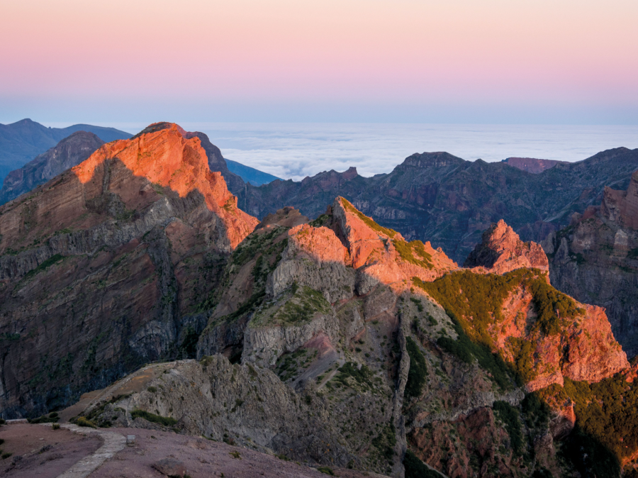
This being Madeira, the ridge path careered up and down, avoiding unclimbable sections by diving deep into ravines on either side of the crest. Sometimes the path fell away, demanding our concentration, but no cutlery was called for. We hauled ourselves onto the summit, aloft over volcanic voids, contorted cliffs and undulating forest.
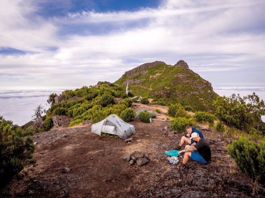
Supplies at the mountain lodge must be hiked in and were exhausted, so we dined on the last of their crisps and shortbread. They suggested a nearby camping spot by the path, and it looked inhospitably rocky at first, but pegs held in meagre soil. Cloud closed in towards dusk, but we were granted a majestic sunset. Cloud above and below took flame, golden rays bounced off Madeira’s summits and the moon ducked behind Ruivo’s silhouette. This was clearly the coolest wild camp of my life.

Cloud filled the dawn as we headed for Pico do Arieiro, Madeira’s third highest mountain. This Pico-to-Pico trail was a highlight, dropping us into wild, bare buckled rock, crossing the craggy precipices of Pico das Torres, cutting into and tunnelling through otherwise impassable rocky blockades. Cables and steps clung on to the edge of the abyss… as did we. Buzzards floating on thermals watched us from above, while partridges grazed and bathed in the dust at our feet.
The end in sight
After feasting at Arieiro we were good to continue. We’d learned that the Madeira Island Ultra Trail requires the backpacker to anticipate the unexpected, and finally, with our lesson drawing to a close, the land sloped gently from the highest ground. Progress was suddenly, unexpectedly swift and easy, save for one closed path, and another that was half overgrown just as a warning. We even managed a second meal.
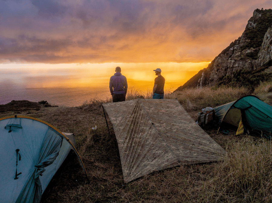
Rain held off on the last cloud-filled day, and we dropped through the laurels to reach the northern Atlantic cliffs by mid-afternoon. Wildness returned with breath-taking views along the coast to the outlying Dragon’s Tail peninsula. We needed to find one more camp among the crag hugging trees, but scoured the winding contours in vain. At last, we found a patch of secluded, flat turf just above the trail. A welcome gift. The boys went for water while I made camp, watched by a peregrine that swooped down from unknown heights to alight on the cliff.
In the predawn light, slate grey clouds showered veils of patchwork rain onto the sea. We watched from our grassy stage, a lasting gaze full of reflection, and the pause delivered another gift: fleeting amber rays dipped under the cloudy shroud, filtering orange though the showers, culminating in golden glory at the base of our cliffs. We had made the finish line, and even though we had strayed a little from our earliest plan, we had been amply challenged, suffered, and been well rewarded in an endeavour that knitted the three of us tightly together. Would we undertake such a challenge together again? You bet we would. Give it a year? “Maybe two” came the reply, but it was sincere.
The Madeira Island Ultra Trail: in brief
Distance: 97km/60miles
Ascent: 6200m/20,350ft (many climbs and descents are gruelling)
Time: 7 days
Start: Porto Moniz on the northwest coast
Finish: Machico on the southeast coast
Accommodation: Funchal is the main accommodation and transport hub. There are hotels and pensions in towns and some villages. Wild camping is not allowed, and fines are possible, however Ian found that it was not only possible, but actually encouraged by locals. Free wild camping site permits are available.
Resupply: shops and restaurants available from towns and some villages. For guaranteed cooked food take a stove. Water taps in villages and most picnic sites. Levadas not recommended for drinking, but a good quality water purification system should render them safe. Streams were often absent.
Maps: Good quality mapping is not readily available. Ian used the Madeira Tour and Trail 1:40,000 map, which was useful for an overview and very good for finding picnic areas for water and overnight camping seemed to be acceptable here. This was backed up with a gpx map from MUIT Maderia and used in gps mapping software.
Travel: Funchal airport is supplied by a number of budget airlines including easyJet, Jet2.com, Ryanair and Tui. Locally, buses to Funchal from airport, and around the island can be found on the Visit Madeira website. Yellow taxis are available from towns to destinations all over the island. Bolt also run taxis.
Learn more about the Madeira Island Ultra Trail at www.miutmadeira.com.
This feature was first published in the January 2023 issue of The Great Outdoors.


