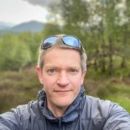
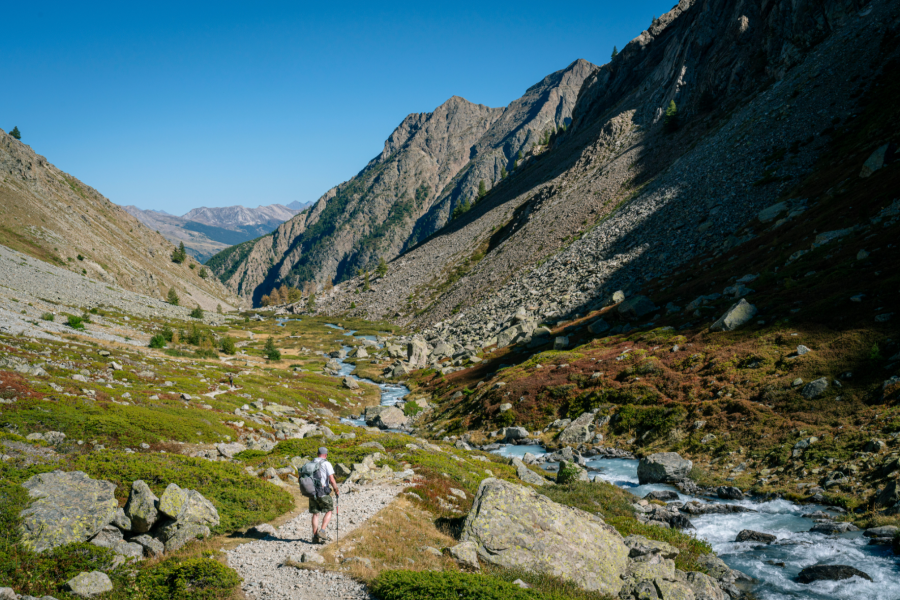
In 2023, I was lucky enough to complete two of the finest walks I’ve ever set foot on. The first was in Britain’s wildest place, bar none – the west coast of Jura (featured in The Great Outdoors in May 2024, should you want a back issue). The second was the Grand Tour des Écrins, aka the GR54 – a two-week circuit of the Écrins National Park in the Hautes-Alpes in Southern France.
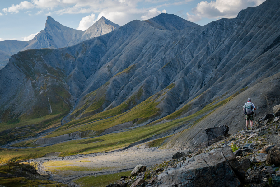
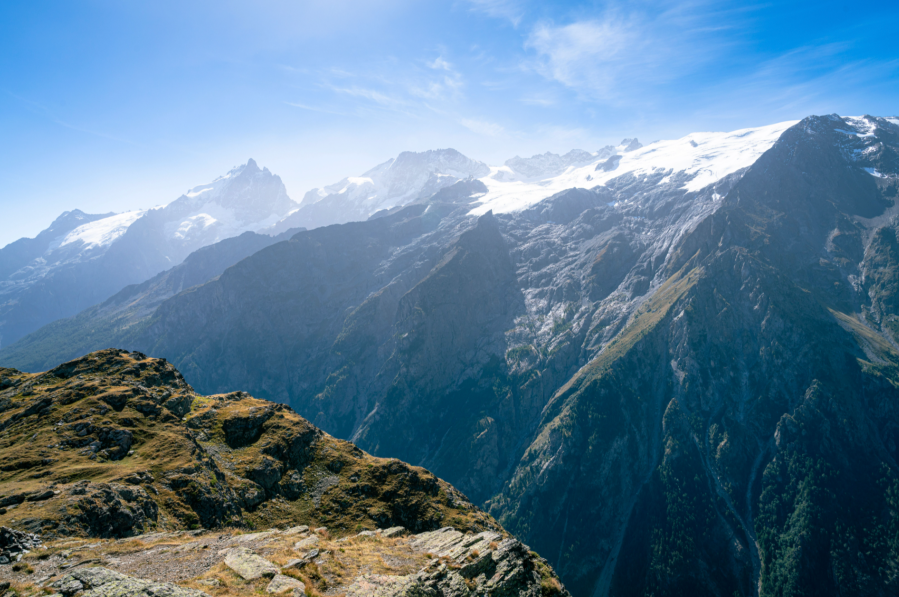
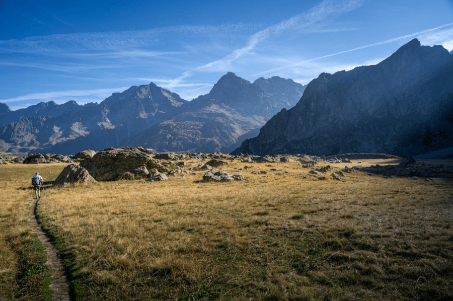
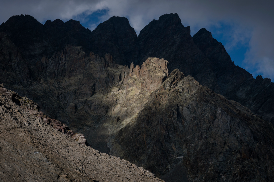
Main image: One of the many singular moments on the trail as we rounded the corner into a high, hanging coire under le Sirac, in the southern part of the GR54 | Credit: David Lintern
The Écrins National Park was founded quite late in the scheme of these things (1973) and is one of France’s largest. Unlike Jura, it’s not defined by edge status – it’s not untamed space in the margins. And it’s not bullied by landed interests or mass tourism like some of our own National Parks, post-pandemic. It feels more like a modest, respectful statement of intent.
Jargon busting
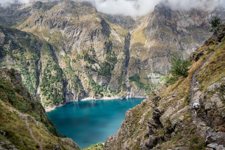
My interest was initially piqued by a protected reserve within the park near Lac du Lauvitel. This so-called ‘wilderness area’ is off limits to all except scientists, who use it to study climate change and to ‘monitor the natural dynamics of ecosystems’ without human influence. Established in 1995, it was one of the first of these areas in Europe.
We got as close as the rank and file are able on our twelfth and final day, only to find our fellow humans congregated in their droves. Whether drawn by the vivid glacial waters or the mystery of a forbidden zone it was impossible to tell, and by that point we smelt too bad to approach anyone to ask.
By way of context and comparison, it might be useful to digress into policy jargon a little. The International Union for the Conservation of Nature (IUCN) uses a category system to classify levels of protection for wildlife and nature within a particular area.
Its interests are eco-scientific, but its work is used in advocacy – as an example, a recent report is being used to petition the Albanian government, who are currently diverting water from within the Vjosa National Park to serve the package holiday industry on the coast.
The IUCN categories range from 1a – a ‘strict nature reserve’ (like Lauvitel) – to Category 6; ‘protected area with sustainable use of natural resources’. These categories are used as measures of wildness, with Category 2 being a ‘national park’. Écrins is regarded as Category 2, but none of the national parks in Britain currently qualify. Most are Category 5 – ‘protected landscape or seascape’. Only 0.01% of our landmass might qualify for the ‘strict reserve’ status.
It is easy to be negative about our nature deficit close to home, but this isn’t a black and white case for Wilderness with a capital ‘W’ and to hell with the consequences. I think the middle ground is more hopeful and more interesting.
Nature and culture
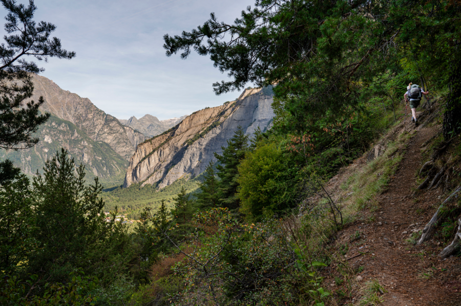
In the first few days, our walk was a waltz under canopies of birch, beech, alder and shimmering aspen, between sleepy village and alpine pass. I’d expected the latter but not the former – the ubiquity and variety of woodland we passed through was a genuine surprise.
The woodlands were old and stuffed full of pine as well as deciduous trees, the paths almost equally ancient and deeply embedded in the landscape. It really added to the rhythm of the walk as a whole. The GR54 is far more than just an Alpine trek.
In Britain, we have about 12% forest cover, while in France it’s more than double that. But those statistics mask more interesting detail – cover in the southeast of France is about 45% and that is majority broadleaf. At the other end of a spectrum, Scottish native woodland cover is around 4%. Latitude makes a difference, no doubt. So does attitude.
The other striking thing in those early days on the trail was the entirely ‘lived in’ nature of the landscape. Seasonal grazing and transhumance are still a huge part of the culture and way of life in the Hautes-Alpes. Sheep’s cheese is still on sale, allotments line the tracks in and out of each hamlet, cows graze in the pasture woods on the edge of town.
Ski infrastructure is present but kept in check. Unlike Scotland, most of the old buildings are not ruins – they are still occupied.
This living landscape extends into the welcome visitors receive. Every two to four days, we descended hungrily on the next village en route. Everywhere had excellent coffee. Local escargot and viande de cheval were both on the menu (though not for me). Le Monêtier-les-Bains was fantastic, with two bakers, a butcher and two minimarkets.
At La Chapelle-en-Valgaudémar, we were treated to gratin, brûlée and local wine – then génépi, thrust into our hands in the bar as we attempted to leave. French mountain panache! The food was local, whole and fresh wherever we stopped, and most shops were independently owned. Hospitality is a measure of a place understood and looked after by its people.
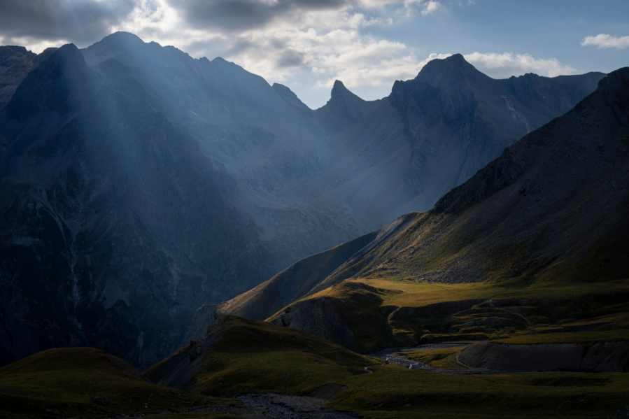
On the third morning, I watched the predawn light grow in the Sarenne group. The shepherd was out early with his kids, corralling their flock in the distance at over 2000 metres. Bells and the cries of children echoed across the grasslands as the day took its first breath.
I thought about how easy it is to exoticize scenes like this when we are away from home, how our own farming communities feel under pressure from an equally pressurised environmental movement (with some British nature defenders now imprisoned for non-violent acts of conscience), and how attitudes on all sides harden when people are cornered.
Hanging in the balance
How are nature and culture, trees and grazing reconciled? With leadership, and compromise. Park access in the Écrins is tiered, with grazing, fires, pets and pushbikes prohibited in some areas. Grazing on the higher ground is seasonal, and fences are mobile and electrified, not permanent, meaning that the flocks are moved on frequently and the fencing with them.
Before we judge ourselves too harshly, these ideas are now being considered afresh in protected areas of Britain. In Abernethy Forest, the RSPB are using temporary fencing with Highland cattle for selective grazing and disturbance of the understorey.
Also in the Cairngorms National Park, ecologists have suggested zoning the interior. In Écrins, zoning has helped wildlife to find sanctuary. Ibex have been successfully reintroduced, while otters, beavers and bearded vultures are returning.
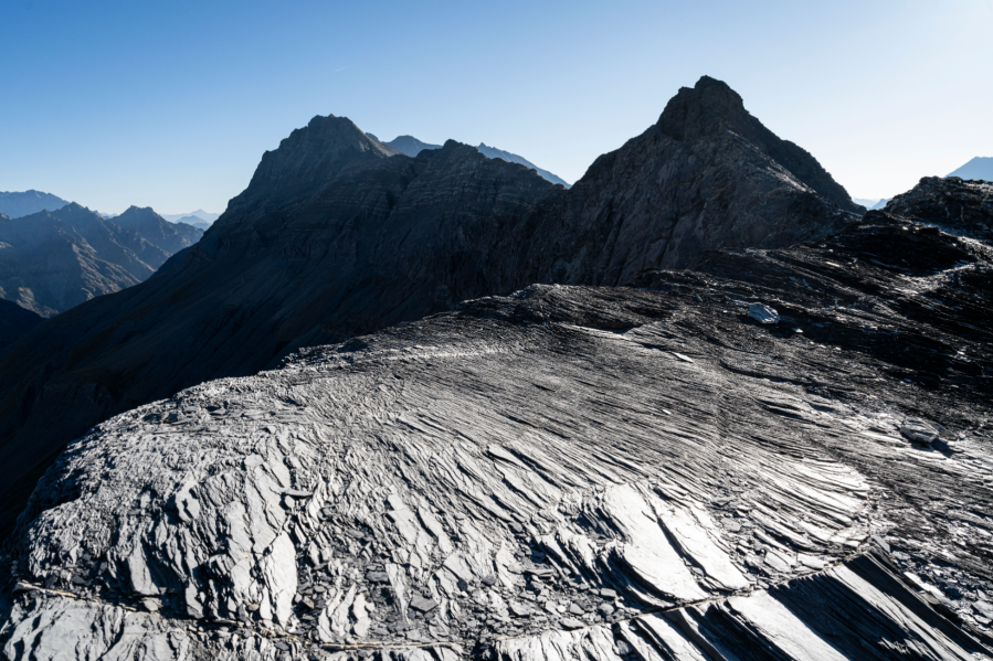
The GR54 led us through woodland and wildflower-decked glades fizzing with insect life, then on into a diverse and vibrant montane belt and to the crumbling peaks and weeping glaciers beyond. That variety felt almost absurdly luxurious.
Of course, the 30-strong wolf population does eat sheep and that’s a source of friction – but the French government have a ‘wolf plan’, compensate for losses and offer bursaries for sheepdogs (patou), fences, food and cabane accommodation.
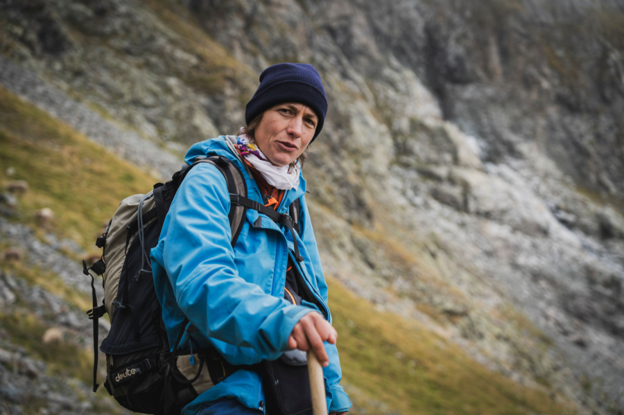
Shepherdess Justine Carpentier lost 150 sheep in 2020, and told me, “The wolf is not good or bad – it is just like the weather. Like rain, we don’t always like it but we need it, and we must learn to live with it.” Others we met were equally philosophical about the challenges. It just seemed to be part of the deal.
The word Anthropocene has become fashionable in recent years, as if human intervention was a new invention. But humans have been changing their environment for tens of thousands of years. What is new is density and efficiency – the scale, speed and impact of our terraforming.
And we already have a word for this: capitalism. British conservation still mirrors that ‘harder, faster’ worldview; and, in the absence of government leadership and investment, leans on legacy donors, carbon credit traders and tax avoiders. Little wonder there is conflict and culture war in our countryside.
By contrast, the Écrins feels like wildness at walking pace – slower and with care. French government protection of regional produce and mountain ways of life reflects a general sensibility and the political will to do something about it. Nothing is perfect and there are real-life tensions everywhere, but the Écrins shows another way is possible.
Take the Grand Tour de Écrins
What: It is reckoned the GR54 is the second most challenging GR in Europe after Corsica’s GR20 – but it’s far less busy.
Where: French Haute Alps
When: The high cols are generally passable between late June and early October. July and August are hot. June has the best flowers, and September calmer weather.
Distance: 180-193km/ 111-119 miles
Ascent: 12,000-12,800m/ 39370-41994ft
Maps: David used IGN 05 Écrins Massif – Grandes Rousses, Cerces, Clarée. At 1:60K, it covers the entire area. When necessary, he cross referenced using digital mapping, although route finding was generally straight forward.
Book: Knife Edge Outdoors publish a guide useful for planning that is slim enough to carry: Tour of the Écrins National Park (2nd ed, 18.99). This contains maps, but the size and reproduction meant having a full map was preferred for route planning each evening at camp.
Time: Between nine and 13 days. David took 12, with a half day of rest at Vallouise. Allow 2+ days for travel.
Start and finish: It’s a circular route, often attempted clockwise from Le Bourg d’Oisan to allow for gentler days at the start. Alternatively, try Vallouise and head ACW.
Getting there: Trains from Paris serve Grenoble, where you can hop on a bus to Le Bourg d’Oisan. Flights run from UK to Lyon, or Geneva (out of high season) connecting to Grenoble. For Vallouise, you can connect from Marseille or Nice. With good planning, you can avoid flying. David met a family of three who had taken the train from Perth in Scotland to Grenoble in a single day, overnighted and caught the first bus to Le Bourg d’Oisan. Their journey time was less than his (by air), and the cost was the about the same because they did not overnight in Geneva!
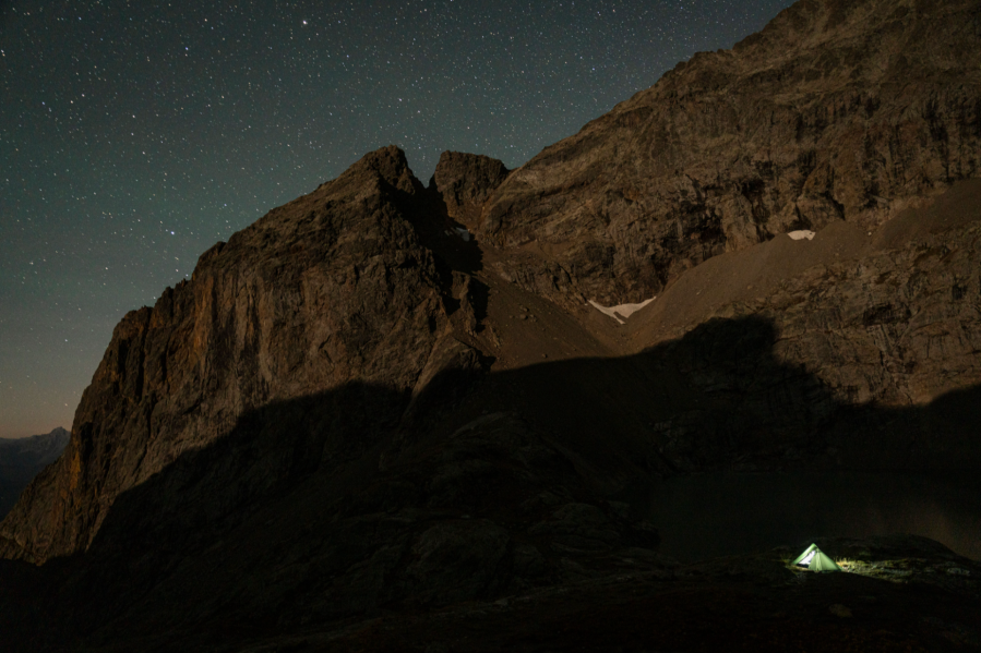
Accommodation: David stayed at Bo Lodge hotel (bo-lodge.com) and Hotel de Milan (oisans.com) in Le Bourg d’Oisan at the start and end of the walk, and in Hotel 05 (hotel-05.fr) halfway in Vallouise. He used the campsite at La Chapelle and ‘bivouacked’ for the remaining days. It is possible to use refuges and hotels for the entire route, but most need to be prebooked, making for a strict itinerary.
Supplies: Approached as a backpack, it’s straightforward to resupply en route every two-to-four days. There are shops at Le Bourg d’Oisan, La Grave, Le Monêtier-les-Bains, Vallouise and La-Chapelle-en-Valgaudemar, but watch for seasonal and Sunday/ Monday closing. Meals and drinks can also be bought from refuges and villages en route.
Getting the balance right – clothing and kit for the GR54
Looking at the Alps from afar and seeing altitudes of 1400-2700m on the map, it’s easy to overpack (and I did), but keep in mind both ascent and latitude. The climbs are even tougher with a heavier bag, and temperatures in early September in the southern French Alps are still warm: 34°C-at-1800m-in-the-shade warm!
At night, it stays mild, and so 2-3 season hiking kit is more than sufficient. In short, ‘cotton kills’ unless you are in the Écrins, in which case it’s probably fine. A long-sleeved summer shirt, lots of sun protection (hat, cream, glasses, keffiyeh) and running shorts were my everyday wear. A windshirt helped over windy cols.
Trail shoes were perfect, with ankle gaiters to keep out the grit – my feet would have melted in boots. I didn’t need the waterproof socks I took. It was so warm in the evening that my trail shoes dried quickly and I didn’t bother with sleep socks.
Take a light down or synthetic puffy layer for evening over your usual camp sleepwear. A simple fleece as a mid-layer is fine. Spare socks were handy but spare underwear was more dead weight – instead, take safety pins, wash in rivers and dry kit on your pack as you walk.
I carried a full 3-season tent and 0’deg sleeping bag but a light, single skin shelter and a summer sleeping quilt would have been ample. I also took the Trail Designs Ti Tri stove, which was perfect – the ability to occasionally and carefully use wood as stove fuel meant a saving on meths weight. Your mileage may vary, but our waterproofs stayed in the pack until the final two days – lighter is better.
Trekking poles were indispensable, more for the steep descents than the ascents.
This feature was first published in the May 2025 issue of The Great Outdoors.