
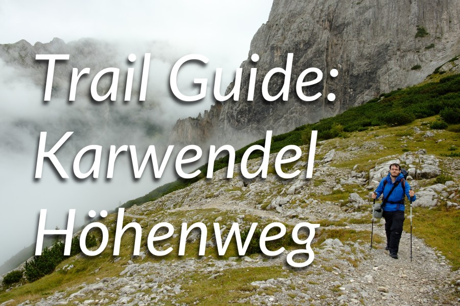
Looking for an exhilarating multi-day trail in a rugged mountain range you might never have heard of? The Karwendel Höhenweg, Austria, could be just what you’re looking for…
By Alex Roddie
This is a paid collaboration with visittirol.co.uk.
I’ve been walking and climbing in the Alps for over a decade now, and yet there is still so much I have yet to experience, so much more to see.
When Visit Tirol invited me to head out to Austria and hike the Karwendel Höhenweg, a multi-day hut-to-hut trail near Innsbruck, initially I had no idea what to expect. But a quick look at Google Images confirmed that this six-day tour through the largest nature park in Austria had the potential to be truly special.
I was not disappointed.
Contents
- About the trail
- Stage 1: Reith to Nördlingerhütte
- The ascent of Reither Spitze (2,374m)
- Stage 2: Nördlingerhütte to Solsteinhaus
- Stage 3: Solsteinhaus to Pfeishütte
- Stage 4: Pfeishütte to Bettelwurfhütte
- Stage 5: Bettelwurfhütte to Hallangerhaus
- Stage 6: Hallangerhaus to St. Magdalenda
About the trail
The Karwendel Höhenweg (or ‘high route’) is a fairly new trail that wends its way through the southern reaches of the Karwendel Mountains. British backpackers and mountaineers might never have heard of Karwendel – it’s a region of the Northern Limestone Alps, mainly in the Austrian state of Tirol, that’s easily accessible from Innsbruck or Seefeld in Tirol. And, despite being little-known here in the UK, it’s a prime destination for Alpine walking.
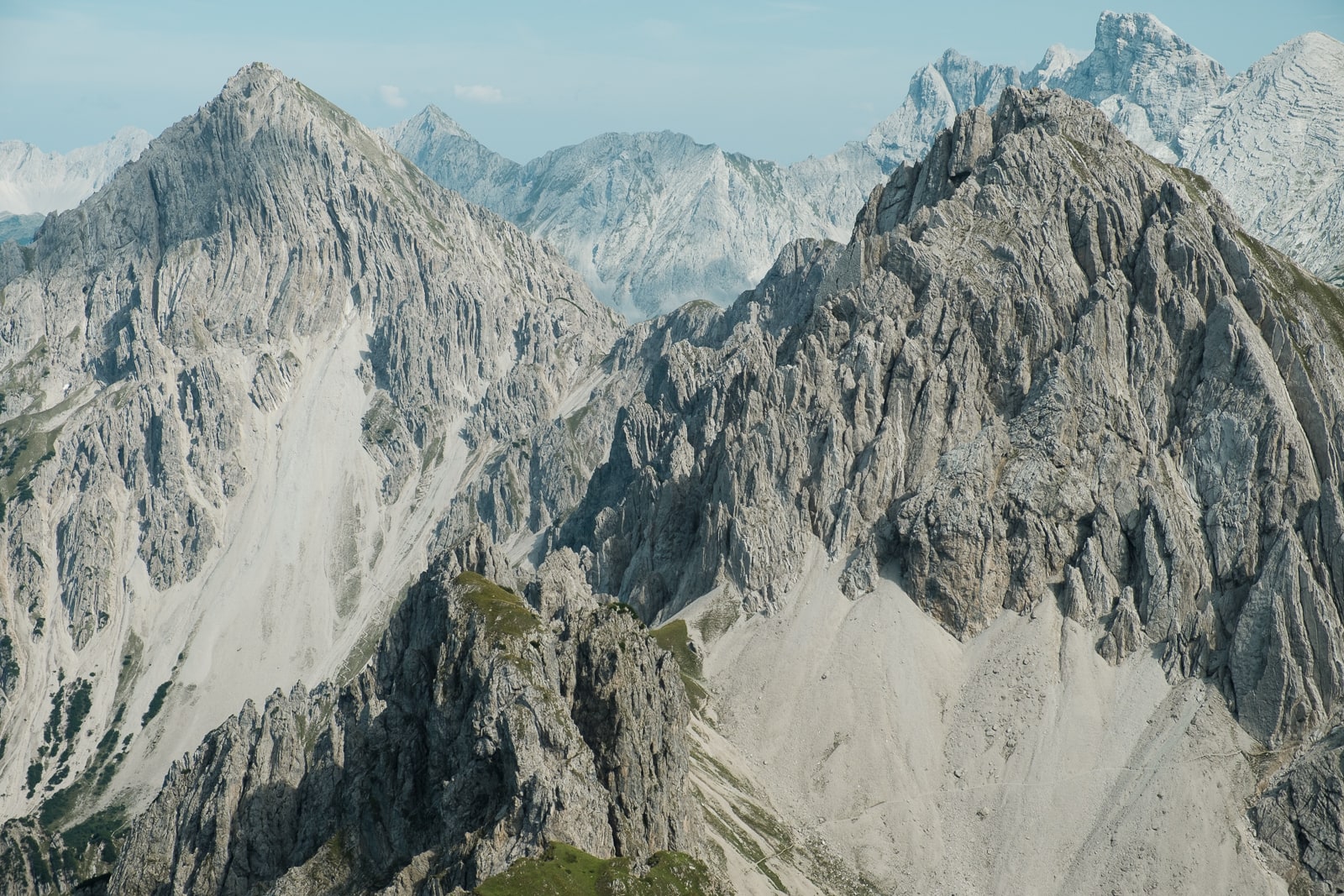
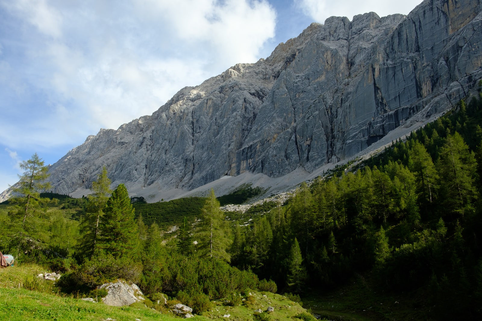
The Karwendel Mountains lie at a slightly lower altitude than some other parts of the Alps. That said, these are still serious mountains: there are 125 peaks over 2,000m, and snow persists on higher slopes well into the summer. Due to the limestone geology, many of the mountains have a striking, pale appearance, almost white in some light.
A few facts about the trail itself:
- Total distance: 63km / 39 miles
- Stages: 6
- Total ascent: around 3,400m (11,000ft)
- Best time of year to hike: June to September
- Starting point: Reith bei Seefeld, Austria
- Finishing point: Scharnitz, Austria (or St. Magdalena, as hiked)
- Accommodation: Alpine huts; booking essential (camping is not permitted)
- Transport: both ends of the trail are well served by public transport to and from Innsbruck (train and bus); see karwendel-hoehenweg.at for more information. It is also possible to join and leave the route from any of the mountain huts
- Further information: visittirol.co.uk, seefeld.com, and the trail’s official website, karwendel-hoehenweg.at
Why should I hike it?
Are you looking for:
- A challenge?
- Beautiful mountain landscapes?
- A degree of wildness you might not have expected?
- An accessible trail, easy to get to from the UK?
- Friendly, well-appointed and well-situated huts?
- Spectacular wildlife?
If yes to any or all of these, then you’ll love the Karwendel Höhenweg. However, lovers of solitude should note that you will meet plenty of other hikers, and to protect the sensitive natural environment no wild camping is permitted.
Am I experienced enough?
The Karwendel Höhenweg is a challenging hike. Although it is well waymarked, many of the trails are black graded, which means that they are very steep, exposed, loose, and involve short sections of easy scrambling (often protected by ironwork such as rungs, steps, or cables). It isn’t a trail for Alpine beginners, but experienced mountaineers will feel right at home.
Early in the season, snow may still be encountered on sections of the route, requiring the use of ice axe and crampons. Fresh snow can fall at any time of year.
Stage 1: Reith to Nördlingerhütte
- Distance: 6.5km / 4 miles
- Ascent: 1,150m / 3,772ft
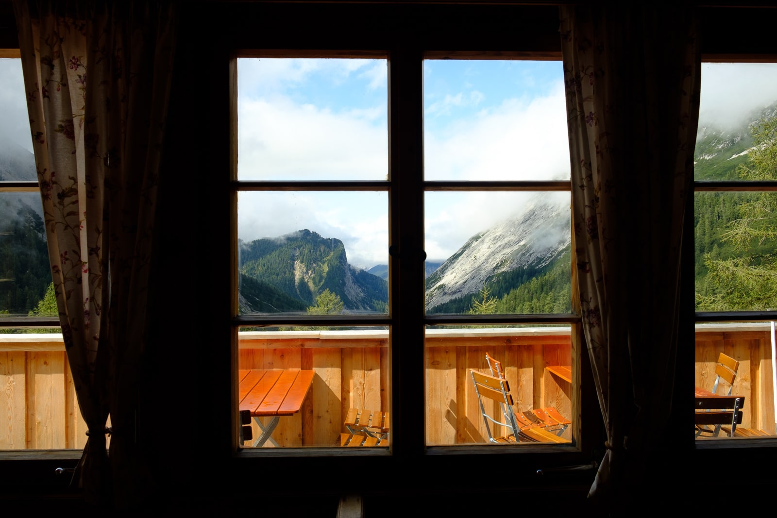
After flying from the UK, I stayed the night at Hotel Seespitze in Seefeld. This hotel made a comfortable base for planning my journey ahead – and the view of the mountains out of my window was excellent.
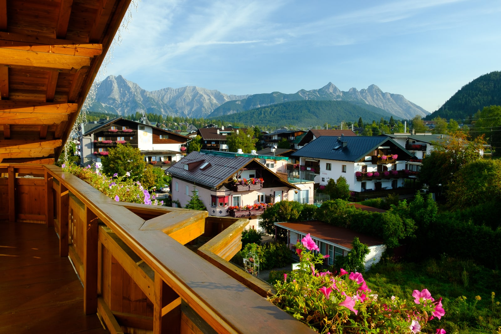
The view from my hotel room window in Seefeld
© Alex Roddie
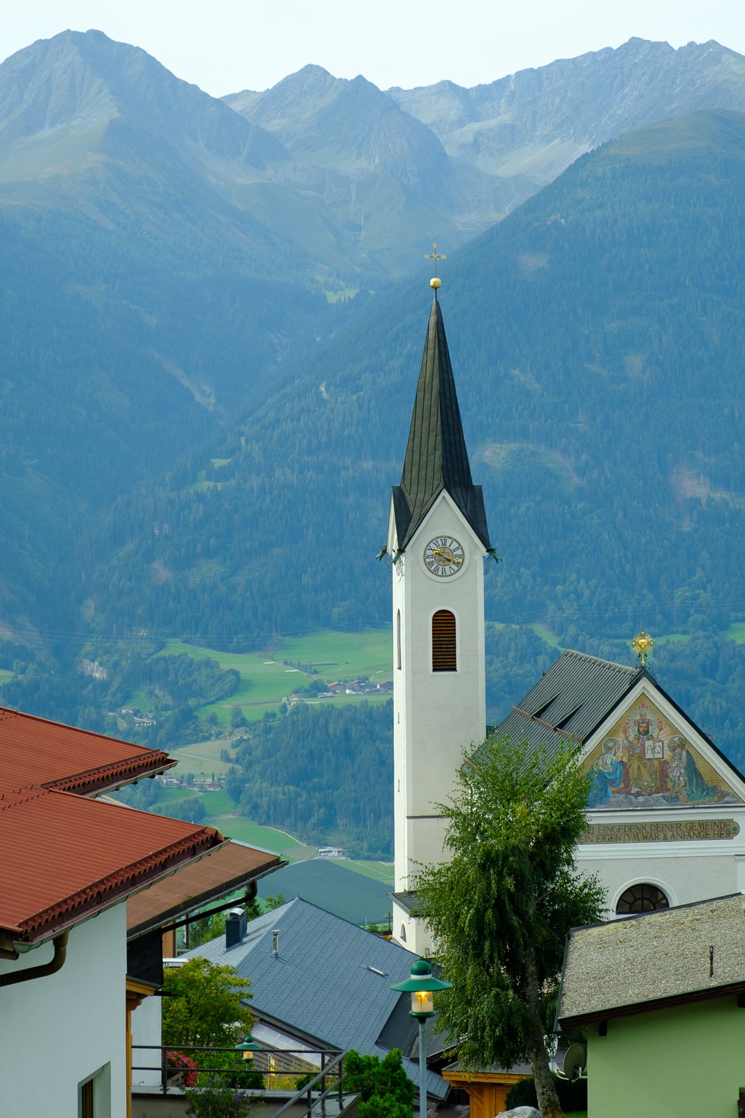
Reith
© Alex Roddie
The trail begins at the charming village of Reith, just down the valley from Seefeld. I dropped in at the tourist information office where Lisa gave me a map – usefully printed on waterproof paper – and my trail passport, with room for a stamp at each hut. This was a nice touch – not only did it give crucial details for each of the huts I’d be staying at, it also provided a taste of anticipation for the journey ahead.
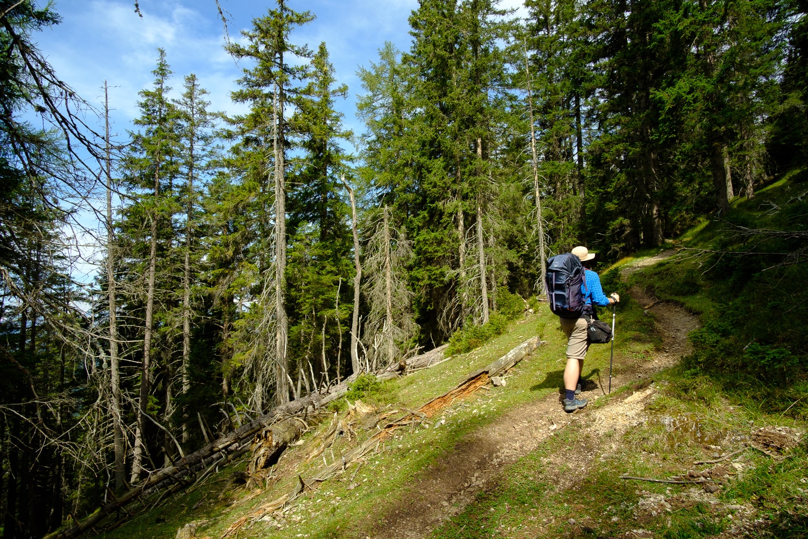
Climbing steeply through the forest
© Alex Roddie
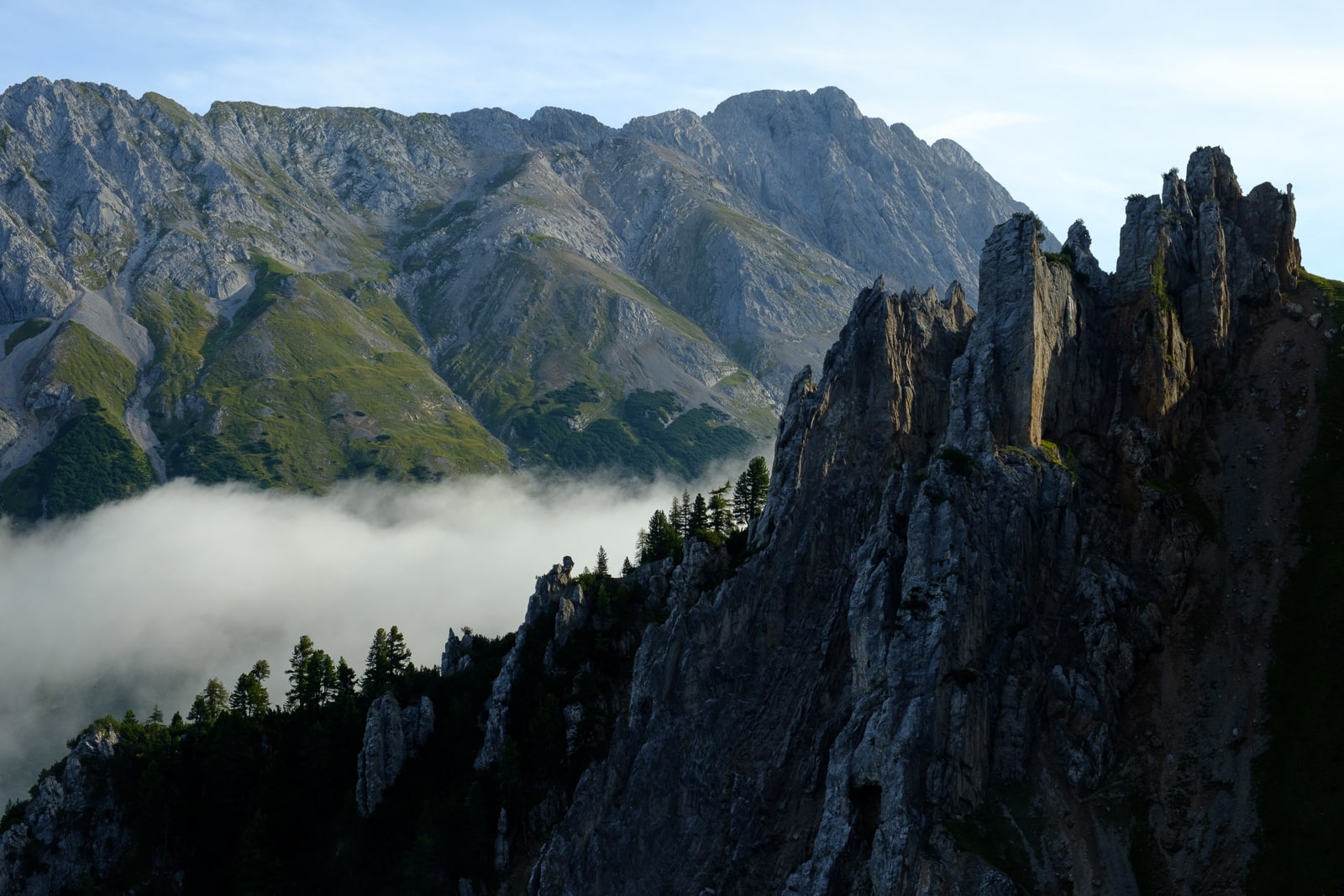
The climb up from Reith village was steep right from the start, taking me through larch forests with a few browsing cattle. I soon crossed the border into the Naturpark Karwendel, and as the trail broke above the treeline I was treated to the first views over the mountains. Unlike in most places in the UK, there is still a natural treeline here – grazing pressure from cattle is low enough not to threaten the forest itself – and I was fascinated to see the dense, low pine scrub that carpeted the mountains above the bigger trees below. With the white bones of the limestone showing through, it gave the peaks an attractive and unusual two-tone look that I hadn’t seen elsewhere in the Alps.
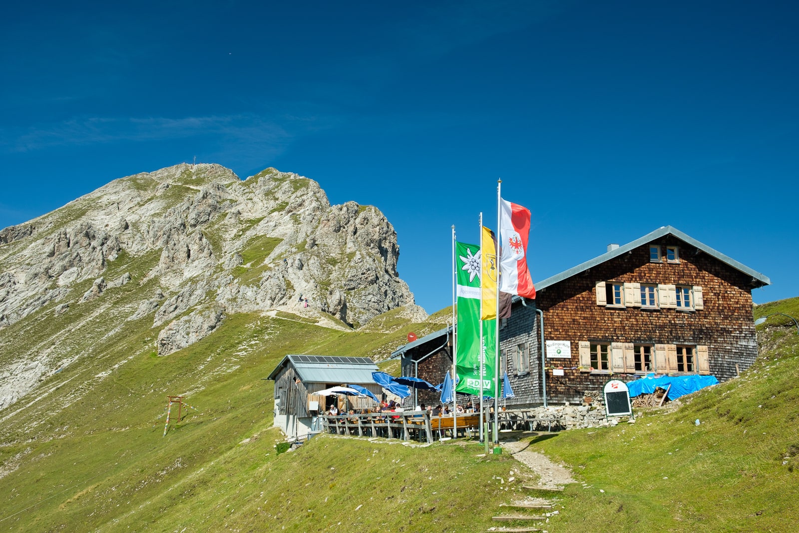
Nördlingerhütte
© Alex Roddie
After following a broad ridgeline with unfolding views of the bigger Karwendel mountains I had to look forward to later on the trail, I soon arrived at Nördlingerhütte (2,239m) – the highest hut I’d be staying at on my journey, perched on the ridge just beneath the final summit pyramid of Reither Spitze.
Hut stop: Nördlingerhütte (2,239m)
- Phone: +43 664 9142262
- Website: noerdlingerhuette.at
Nördlingerhütte made a wonderful place to spend the night. The guardian, Tobias, chatted with me about the views I’d see if I headed up nearby Reither Spitze. There were several groups of walkers staying in the small hut, most doing a section of the Höhenweg. The highlight of my stay was most definitely the delicious Kaiserschmarren (sweet pancakes, served as dessert).
The ascent of Reither Spitze (2,374m)
Reither Spitze is a short ascent – the summit is just over 100m higher than the hut – but interesting, with a long scrambly section equipped with chains for safety. At the summit the full impact of the views north and (particularly) east, over the remainder of the Karwendel Höhenweg, can be enjoyed – it’s a truly breathtaking panorama, especially if you creep right to the edge and point your camera down at the screes hundreds of metres beneath. For the first time I could see the full scale of the challenge ahead of me, and I couldn’t wait.
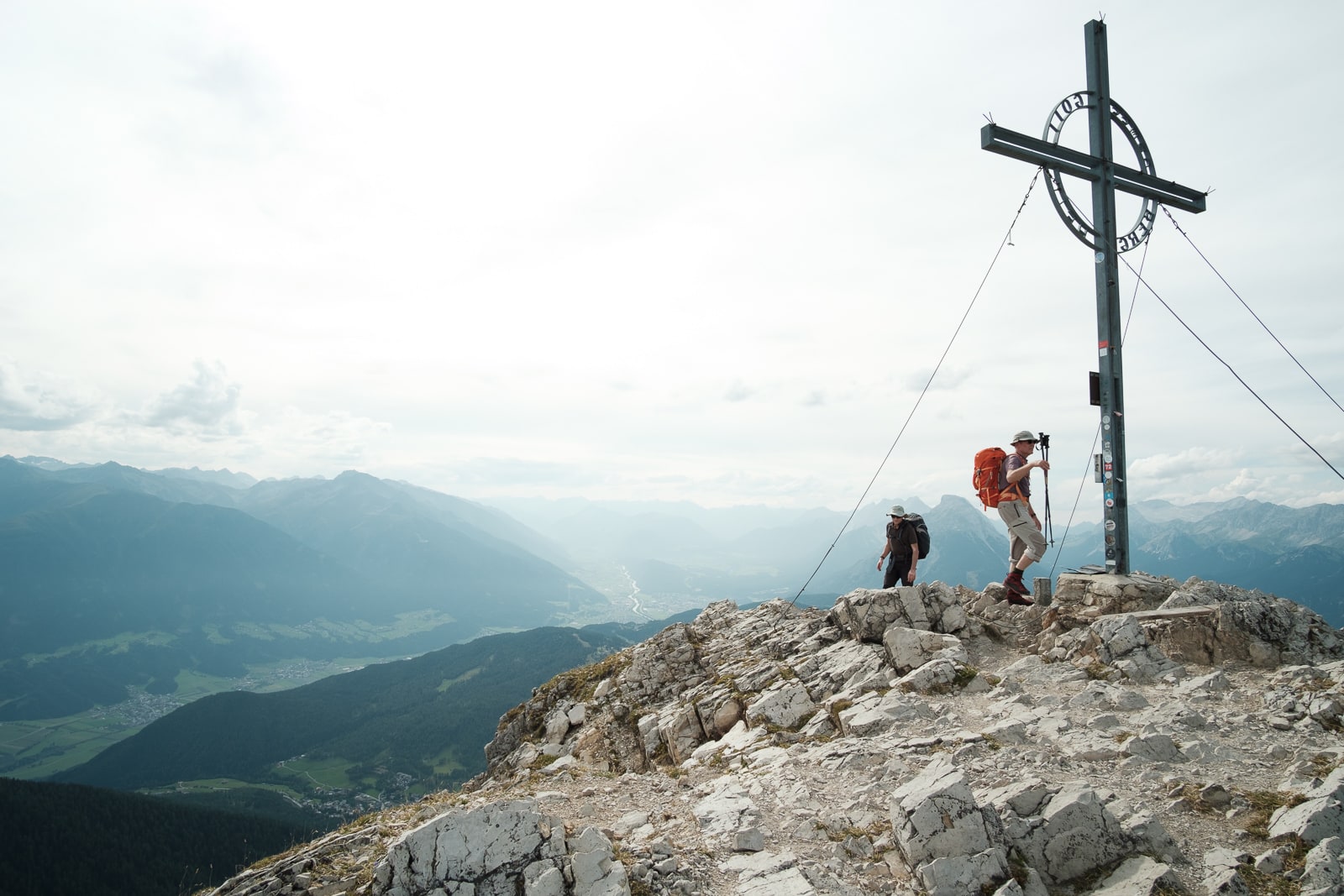
The summit
© Alex Roddie
Looking along the ridge…
© Alex Roddie
…and a looong way down!
© Alex Roddie
Stage 2: Nördlingerhütte to Solsteinhaus
- Distance: 6.7km / 4 miles
- Ascent: 350m / 1,148ft
The beautiful weather sadly disappeared overnight, to be replaced by wind, rain, and much colder temperatures. Tobias was concerned for the Höhenweg hikers, and recommended that we hike together to Solsteinhaus – a wise move, I agreed, given the far more technical terrain lying ahead, with much exposed ground and a high col to negotiate.
I left the hut with a group of German hikers tackling the western section of the Höhenweg, and soon got chatting with several of them as we walked. They were a group of friends and colleagues who worked together at Bosch and came to hike in the Austrian and German Alps each year. ‘We never see English hikers in these mountains,’ one told me almost immediately. ‘You’re the first we’ve seen this trip.’ Another, Anne-Helene, said, ‘This weather must be making you feel right at home!’
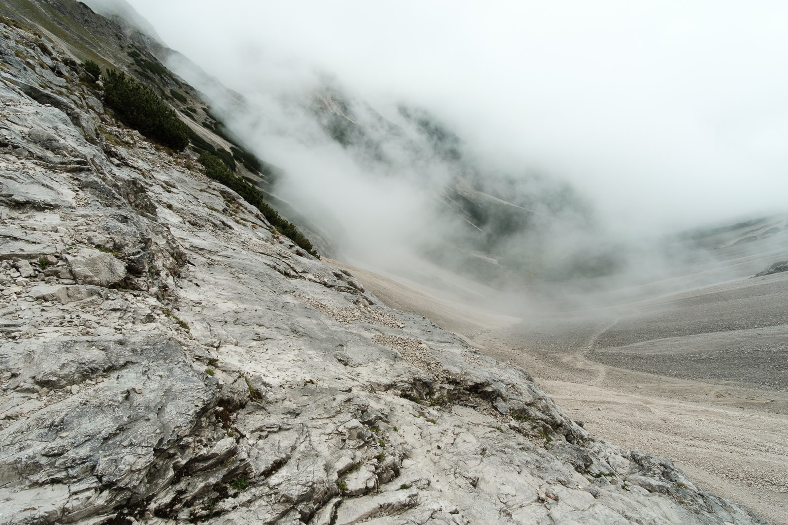
We hiked in the cloud for most of the day, with sporadic heavy rain that made the limestone slick and treacherous underfoot, especially on loose sections of scree. I felt disappointed to be missing the views at first, but soon came to appreciate the magnificence of the mountain architecture in mist. It became an enchanted landscape, accentuating the steepness of the rock bastions all around.
Challenging black-graded terrain
© Alex Roddie
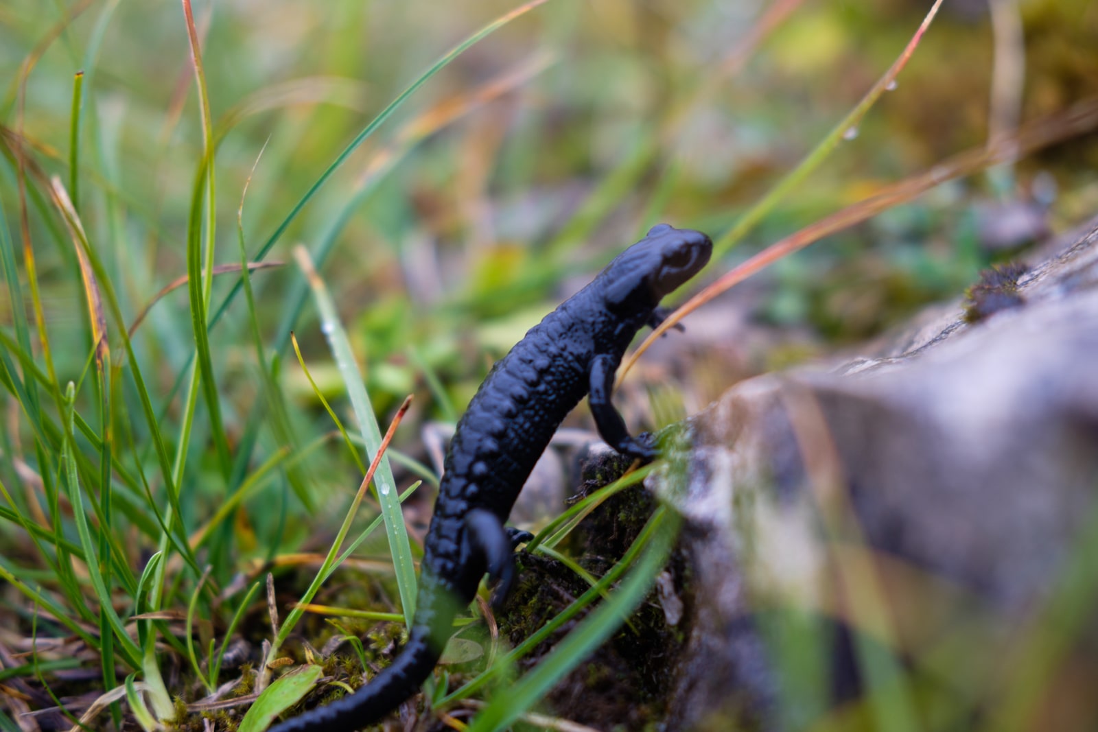
Alpine black salamander
© Alex Roddie
It wasn’t long before I spotted a tiny animal on the path at my feet. ‘It’s an Alpine black salamander,’ one of my new friends said, and gently lifted the little amphibian, gleaming like wet coal, out of the way. We passed dozens of them. I later discovered that they are common in certain parts of the Alps, but only come out in the wettest weather.
Despite the leisurely mileage between huts, I found the hike to Solsteinhaus challenging – it was a technical walk in places, made more so by the dramatic weather.
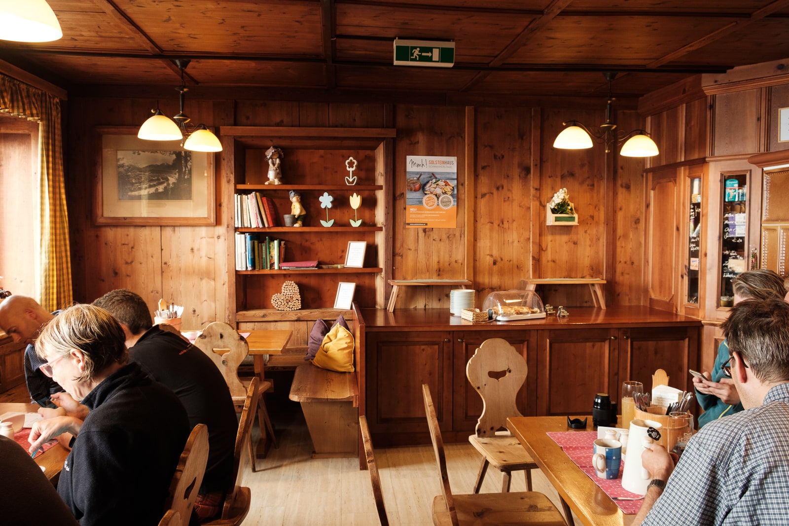
Hut stop: Solsteinhaus (1,806m)
- Phone: +43 664 3336531
- Website: solsteinhaus.at
Established in 1914, Solsteinhaus is a much larger hut and has a few more luxuries, including a drying room and running water. Robert, who has been guardian at the hut since 2003, told me that it’s a popular place for both hikers and alpinists – the hut is at the confluence of several major trails, and peaks such as Erlspitze (2,405m) and Großer Solstein (2,541m) offer an irresistible draw for mountaineers. We chatted about route options for the next day and, based on the continuing poor forecast, Robert advised me against taking the high ridge route via Seegrube to Pfeishütte. I couldn’t help feeling disappointed – the shapely ridge looked like the best bit of the whole route – but Robert made the foul-weather variant through the Samertal forest sound pretty good.
Solsteinhaus
© Alex Roddie
Stage 3: Solsteinhaus to Pfeishütte
- Distance: 16.5km / 10.25 miles (19.9km / 12.35 miles as hiked)
- Ascent: 1,303m / 4,274ft (1,160m / 3,805ft as hiked)
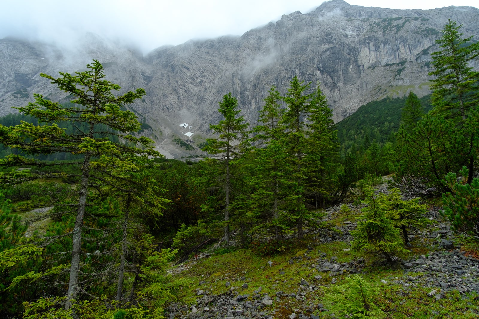
I said goodbye to my group of new friends – they were heading south towards the Brunntal – and took the trail north, soon dropping into lush and dripping Alpine forest. Although the weather remained damp and cloudy, this only emphasised the atmospheric nature of the forest, which got wilder and more diverse as I hiked through it.
This was a solitary section of trail, and the longest on my trip. The path soon began to climb again, leaving bigger tracks behind and passing between silent ranks of pine and larch. A dense undergrowth of bilberry, birch, hazel, alder, rowan, and other plants – most starting to show the first hints of autumn – completed the picture, and I was delighted to see huge old-growth trees here and there. Salamanders could be seen everywhere, and I spotted several chamois. This was not pristine wildwood, but it was closer to it than I’d imagined possible in the busy European Alps.
Glorious Alpine forest. My happy place!
© Alex Roddie
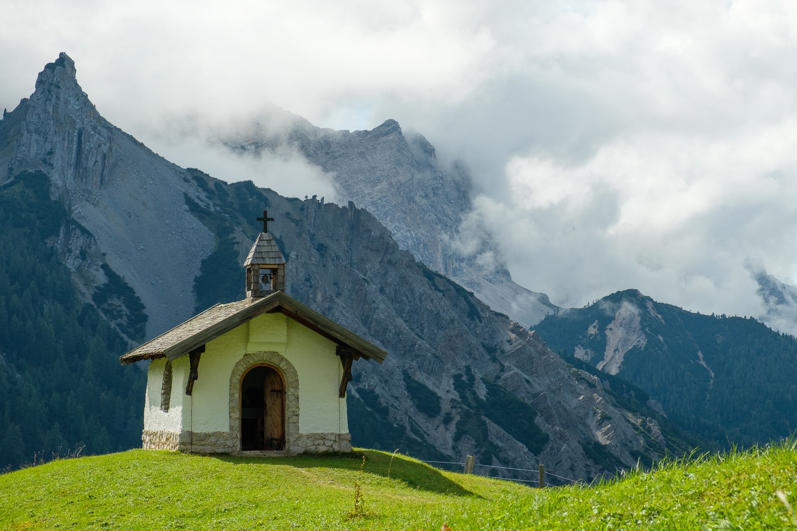
After traversing the mountain’s northern flank for a few miles, I descended a broad track to the mountain lodge of Möslalm (there’s a tiny and rather photogenic chapel nearby) and then followed easy trails up the Samertal Valley to Pfeishütte. I was glad I’d stayed down in the valley and avoided the worst of the weather up high, but as foul-weather alternatives go I’d enjoyed every moment – there’s something magical about wandering alone through a silent and raindrop-jewelled Alpine forest.
Hut stop: Pfeishütte (1,922m)
- Phone: +43 720 316596
- Website: pfeishuette.at
Pfeishütte delighted me from the moment I stepped through the door into a candlelit hallway that had something of a Hobbit hole vibe. Few people were staying at Pfeishütte thanks to the weather. I had a small room to myself with two bunks and a fold-out desk, which was ideal for writing in my journal, but unfortunately there was not much of a view thanks to the persistent low cloud! The Pfeishütte has a cosy lounge with a roaring log-burning stove and a friendly dog who likes nothing better than to wander around and say hello to the guests. The food was exceptionally good at this hut.
Stage 4: Pfeishütte to Bettelwurfhütte
- Distance: 8.9km / 5.5 miles
- Ascent: 500m / 1,640ft
After an excellent breakfast beside the fire at Pfeishütte, I packed up and got going by about 9am, eager to experience the section of trail known as the ‘Wilde-Bande-Steig’: an improbable traverse cutting across the wildest and most exposed mountain terrain, constructed in the 19th century by Innsbruck’s first Alpine club, the ‘1. Alpine Gesellschaft Wilde Bande’.
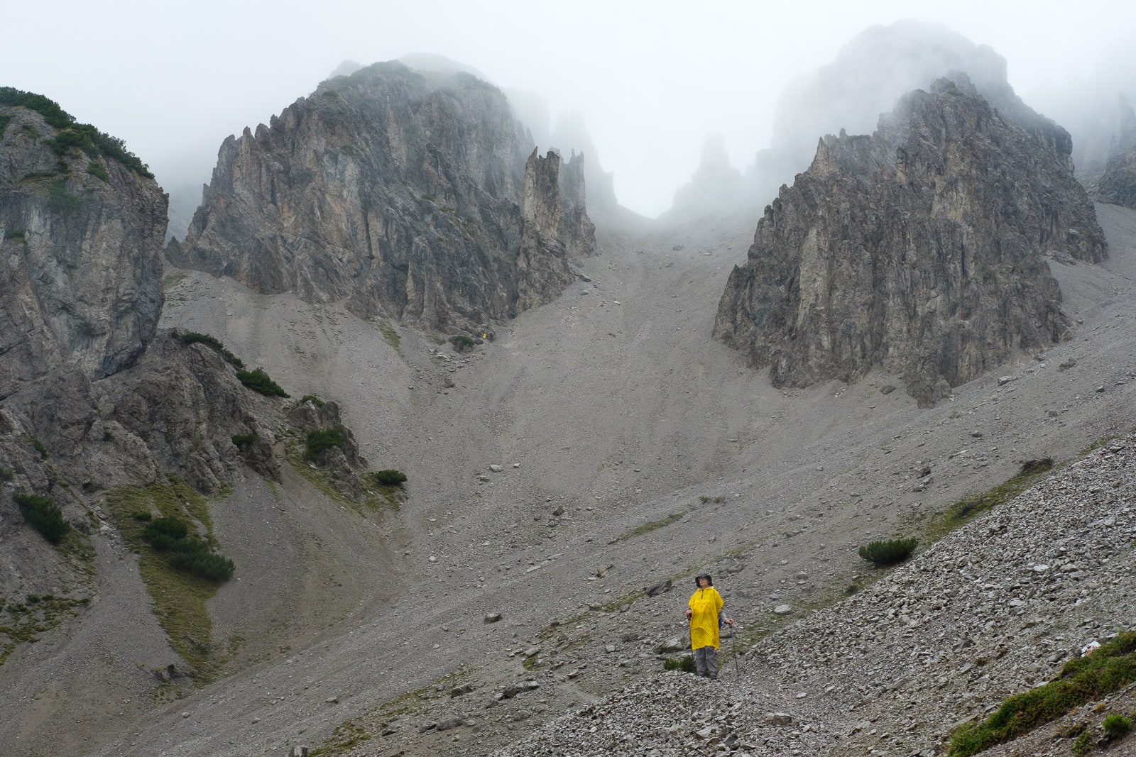
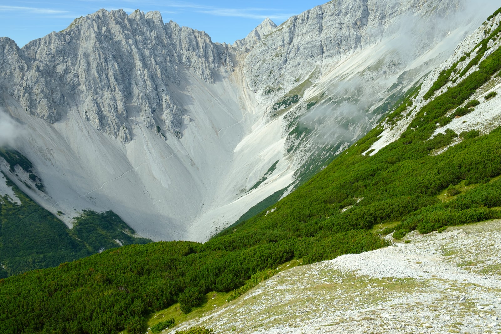
I climbed up to the Stempeljoch – the sharp col beneath Stempeljochspitze (2,543m) – in swirling cloud. When I reached the col I could hardly believe the precipitous drop hundreds of metres to the valley below, down the biggest scree slope I had ever seen. It made the Great Stone Chute on Skye look like a flat path! This was the hardest section of the trail, with a technical descent down shifting scree prior to an escape left to join the Wilde-Bande-Steig itself. A sign warning against stonefall gave me a hint of what I’d let myself in for, but as I descended I soon realised that a safe route had been built between the constantly shifting piles of rock, and it wasn’t as bad as it looked.
Looking down from the Wilde-Bande-Steig
© Alex Roddie
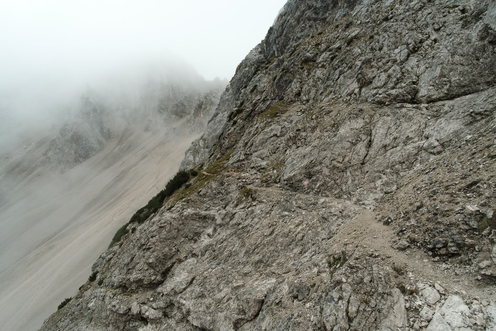
It’s a cunningly constructed route across serious terrain
© Alex Roddie
The Wilde-Bande-Steig diverted left beneath an imposing overhanging cliff, then cut directly across the crag itself. From a distance it looked like you’d need climbing gear to cross the traverse, but up close it proved itself to be a well-constructed and perfectly safe path – albeit one you’ll want a head for heights to feel comfortable on. The most technical section was soon behind me (with a couple of scrambly moments) and the remainder of the trail crossed open mountainsides to Bettelwurfhütte, an outlying point on the the Karwendel Höhenweg – but one well worth visiting.
Hut stop: Bettelwurfhütte (2,079m)
- Phone: +43 5223 53353
- Website: bettelwurfhuette.at
I arrived at Bettelwurfhütte to find it almost completely deserted. The guardians, Christine and Ralf, made me feel welcome in the large common area where I warmed up with a cup of coffee in front of the stove. I soon learned that most of the people who had booked to stay that night had called up to cancel – the bad weather was putting walkers off – but three others were staying with me, including Joe, a scientist from Cambridge who was on his first Alpine trip. We had a convivial evening over beers, talking about mountains and trekking throughout Europe.
Stage 5: Bettelwurfhütte to Hallangerhaus
- Distance: 5.8km / 3.6 miles
- Ascent: 300m / 984ft
Stage 5 might have been a short day, but it was more than worthwhile. The weather began to improve almost as soon as Joe and I left the hut that morning, traversing the steep slopes beneath Speckkarspitze (2,621m) towards Lafatscher Joch (2,081m). I’d passed this col in cloud the day before but now, with slightly better visibility, I began to see the outlines of jagged mountains rearing up into the sky above curling tatters of mist. Joe headed down in the direction of Hall in Tirol while I continued onwards. Raindrops sparkled on the low pine scrub and I saw a number of chamois bounding from rock to rock on the heights.
The cloud began to lift
© Alex Roddie
The final descent to the next valley had some of the best views of the entire trip. Vast rock walls surrounded me on all sides, improbable cliffs that cradled snow patches and areas of pine scrub. I hesitate to use the term Tolkienesque – there weren’t actually any orcs anywhere in sight – but it’s hard to think of a better adjective.
After checking in at Hallangerhaus, I couldn’t resist going for a hike further up the valley, towards the Überschalljoch (1,912m). The weather had cleared by this point and I spent several happy hours just marvelling at the juxtaposition of dense forest and vertical rock faces many hundreds of metres high, capped by the most improbable spires and pinnacles between which eagles and ravens soared. Unforgettable.
This valley had some of the finest views of the entire trip
© Alex Roddie
© Alex Roddie
Hut stop: Hallangerhaus (1,768m)
Hallangerhaus was larger and busier than most of the others I’d stayed at. It’s at a popular location for walkers, mountain bikers and climbers – the woman who served dinner was a climber herself, and her enthusiasm for the big, clean rock walls all around was infectious. Hallangerhaus has recently been modernised with a large extension and I had a small private room with superb views out to the summit of Lafatscher Roßkopf (2,494m).
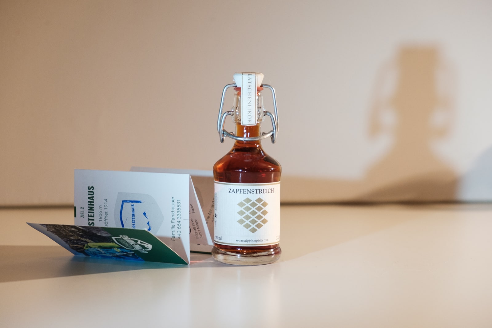
At Hallangerhaus, as I had collected my last hut stamp of the trip, the guardian Thomas presented me with a small token representing my completion of the trail: a miniature bottle of Zapfenstreich Alpine Spirits, a delicious locally produced liqueur that tastes and smells of the pine forests throughout which I’d wandered.
Hallangerhaus
© Alex Roddie
© Alex Roddie
Stage 6: Hallangerhaus to St. Magdalenda
- Distance: 9.7km / 6 miles (as hiked)
- Ascent: 313m / 1,026ft (as hiked)
The official sixth stage of the trail heads west towards Scharnitz, following the River Isar through dense forest, but my itinerary was to finish at the hamlet of St. Magdalena, south of the Karwendel Mountains for an easier journey back to Hall in Tirol.
I took my time returning to the Lafatscher Joch, enjoying the early morning sunshine and the frosty bite to the air. From the col I caught an excellent view of the big scree slope coming down from Stempeljoch (stage 4), and it looked even more improbable from this angle – so pale and uniform that, if you squinted a bit, it looked almost like cones of avalanche debris at the foot of a wintry crag.
A jaw-dropping view back to Stempeljoch
© Alex Roddie
I descended the switchback trail to the valley, passing through zones of pine scrub and then deeper forest, where the early autumn colours delighted me. When I started to reach signs of human activity at around 1,700m, I was intrigued to see a number of large, well-built stone cairns and other traces of industry by the side of the trail. I later discovered they were the remains of an old salt-mining industry in this valley.
My walk ended at St. Magdalena: a hamlet with a medieval chapel, a restaurant (sadly closed), and a couple of houses. In the 20th century this place had been a tourist attraction in its own right, thanks to the beautiful views of the surrounding mountains, and I spent a while just sitting on a bench, gazing out into the wooded heights.
The Karwendel Höhenweg was a uniquely enjoyable and chilled-out trail. The pace was slow enough to really enjoy and savour each section. As someone who often seeks those big miles on a long-distance route, it was a nice change to slow down and focus on the landscape instead of the mileage. And, while I’ll always love wild camping, it can’t be denied that sometimes it’s nice to spend the night in a well-appointed mountain refuge with good cooking and somewhere to dry out your wet things.
© Alex Roddie
For my final night in Austria, I stayed at Gartenhotel Maria Theresia in the city of Hall in Tirol – luxurious accommodation, excellent food, and well situated for views looking back up into the Karwendel Mountains.
All images © Alex Roddie
My thanks to visittirol.co.uk for organising my hike along the Karwendel Höhenweg. Visit their website to begin planning your own hiking trip to Tirol.


