
In the 80th anniversary year of Wainwright’s ‘A Pennine Journey’, David Pitt explains how the modern trail came to be – a long walk in the spirit of Wainwright himself
![]() This year, to commemorate the 80th anniversary of Wainwright’s big 1938 walk, the Pennine Journey Supporters Club is organising a charity fundraising event – PJ-in-a-Day 2018. This marathon fundraising event on 29 September 2018 will involve each charity getting some of their members or supporters to walk a section of the Pennine Journey, raising funds by sponsorship for their own charity.
This year, to commemorate the 80th anniversary of Wainwright’s big 1938 walk, the Pennine Journey Supporters Club is organising a charity fundraising event – PJ-in-a-Day 2018. This marathon fundraising event on 29 September 2018 will involve each charity getting some of their members or supporters to walk a section of the Pennine Journey, raising funds by sponsorship for their own charity.
Email pjinaday@penninejourney.org.uk for more information.
The marathon route follows the modern recreation of ‘A Pennine Journey’, which is a long walk first done in 1938 by Alfred Wainwright. To tell the story of ‘A Pennine Journey’ and how it came about, we invited David Pitt to write about the making of this long-distance trail…
By David Pitt
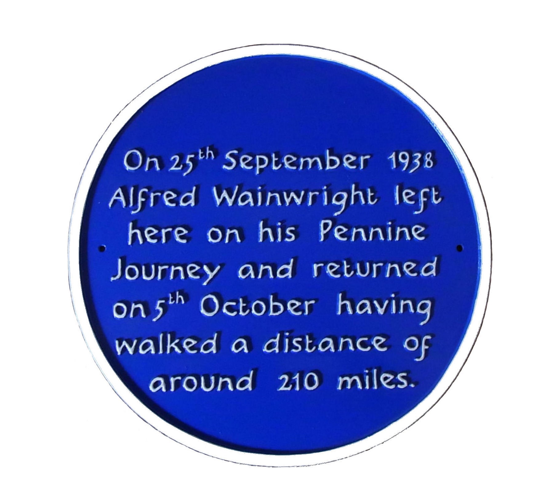
Plaque at Settle station
In September 1938, Alfred Wainwright (AW), now well known for his Pictorial Guides to the Lakeland Fells in Cumbria, England, made a solitary walk through the Pennines as the storm clouds were gathering over Europe.”‘There seemed no escape from the atmosphere of gloom and despondency… things were getting worse day by day. But I was fortunate in having a fortnight’s holiday due, and I fled the familiar scene.” wrote AW a year later.Other travellers in Britain, going back many years, had written about their journeys – but his idea of a long-distance walk could be said to have been the seed corn that has led to the wonderful variety of walking routes in Britain today.
He had taken a break from his job as a clerk at Blackburn Town Hall and headed to Settle in North Yorkshire for his walk “…which should take me by way of the Yorkshire Dales and Durham along the eastern flanks of the Pennines as far as Tynedale, from which faraway valley I planned to return along the western slopes of the range.”During the walk he sent back postcards on which were probably his first landscape sketches. The following year he wrote a narrative description of the walk, showed it to some colleagues and put the manuscript away in a drawer where it remained untouched for nearly 48 years.
We devised a route that would take us to as many of the places AW mentioned in his book as possible, using public rights of way and not the roads that he used in 1938 – a route that AW might have chosen if he were planning it today
Nearly 30 years later, before AW wrote the Pennine Way Companionin 1968 – still for many the definitive guide to Britain’s first National Trail, something he had planned during the 1950/60s whilst engaged on his fells guides. Then, after writing his pictorial guides, Walks on the Howgill Fellsand Walks in Limestone Country, covering an area close to where he lived in Kendal, in 1973 he published his Coast to Coast Walk – now one of the world’s most popular walks, which passes 200 yards from where I live.
Perhaps here I should mention my introduction to long-distance footpath walking. It was in the mid-1970s that I came across AW’s guide to the Coast to Coast Walk, being already familiar with his pictorial guides through my father (who had retired to the Lakes, and who took me and my elder son up a variety of fells on visits). In 1978 I was approaching my enforced ‘retirement’ from the Round Table movement – and had been considering how I could mark this event. I wondered, provided I could get myself fit, if the Coast to Coast Walk could be the answer. I planned a ‘final fellowship fling’ being hosted at the end of each stage by members after being met at a pub with further conviviality following when I would have loved to go to bed. Not surprisingly I arrived at Robin Hood’s Bay totally exhausted with the firm resolve never to get involved in any similar venture. However, when the fatigue and blisters were no more, I remember experiencing a warm glow of satisfaction on my achievement. Next year my father, then aged 77 and doing his only long-distance walk, joined me along the 84-mile Dales Way: thus began a sequence of annual long distance walks that has continued to this day.
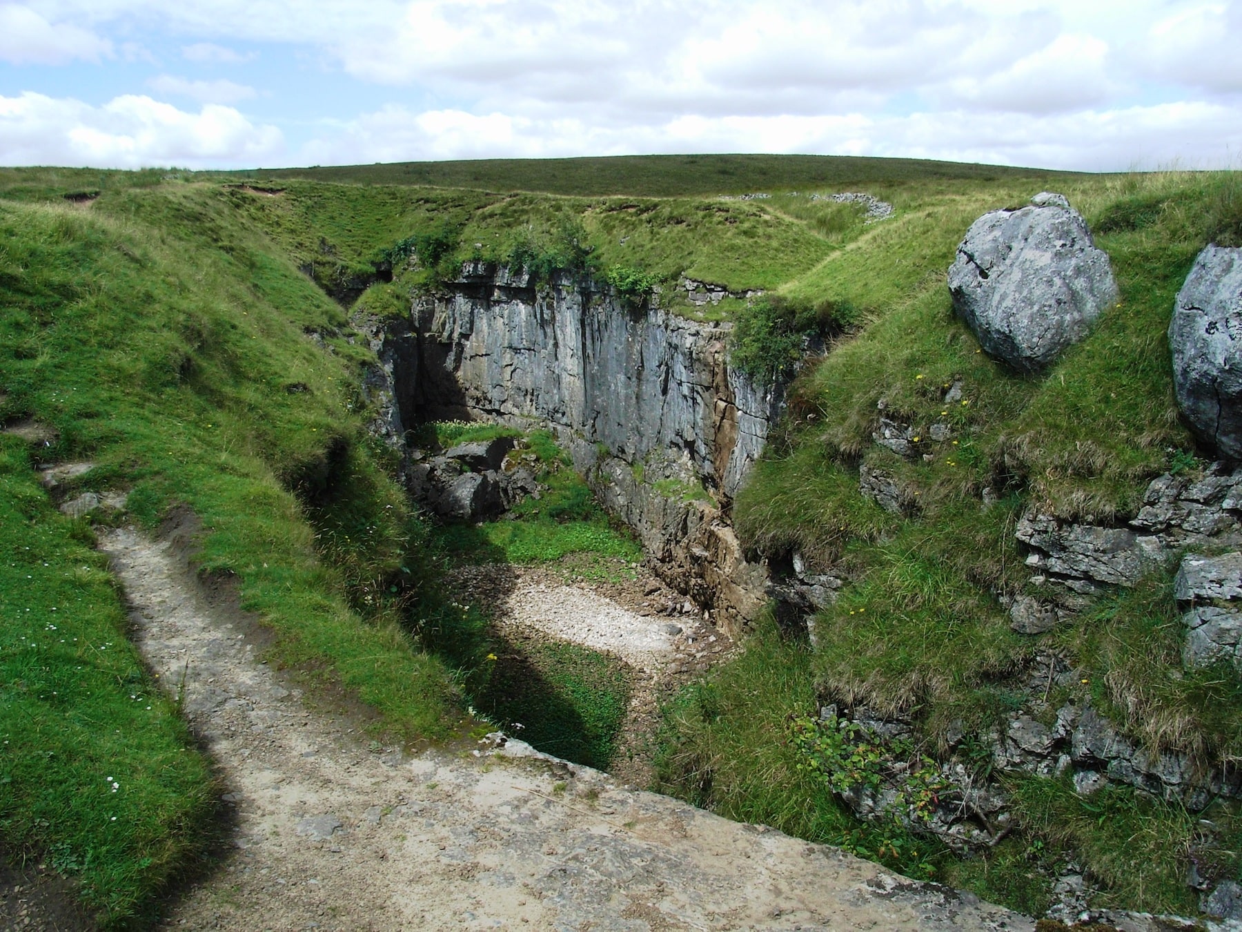
Hull Pot
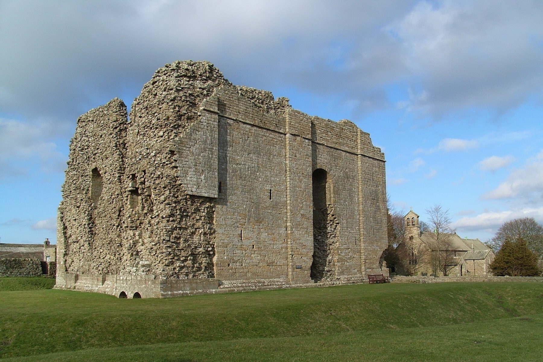
Bowes Castle

High Force
My wife, Heather, was introduced to the fells and long-distance walks soon after we met, and in 1986 we learnt of the publication of A Pennine Journey – The Story of a Long Walk in 1938. This had arisen when, whilst working with AW on Wainwright on the Pennine Waybook, his editor was told of it and persuaded him to publish it.
***
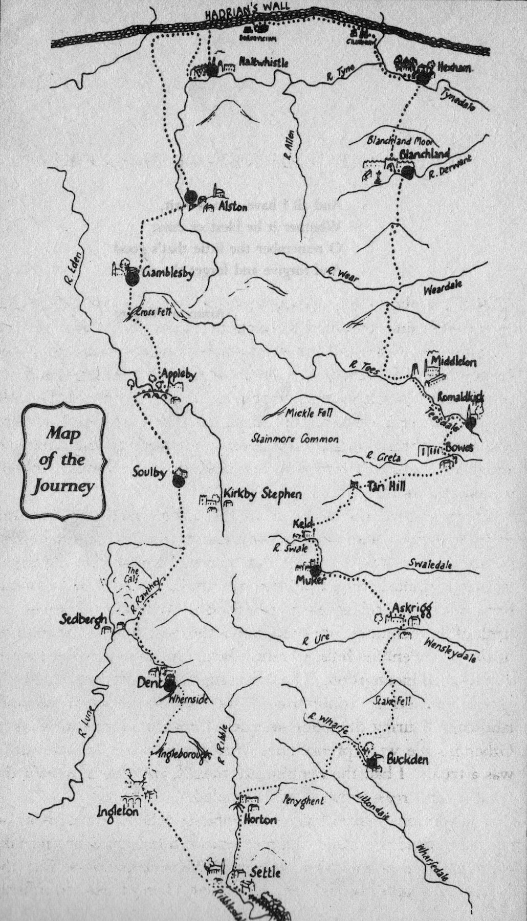
AW’s original map
By the time it was published we had completed our first Wainwright round of the Lakeland fells and were firm AW admirers and long-distance footpath walkers, having completed the 630-mile South West Way in 5 stages from Poole to Minehead in 1986. Others followed and in 1991 my early retirement was celebrated by walking the South Downs Way from Eastbourne to Winchester Cathedral, from where we set out on a mixture of the North Downs Way and the Pilgrims Way to Canterbury Cathedral.
After I retired, whilst Heather and I were debating what was to be our next walk, I remembered the following extract from the introduction to AW’s Coast to Coast Walk guide advising walkers to “….devise with the aid of maps their own cross-country marathons and not be merely followers of other people’s routes”.AW’s ‘A PennineJourney’ came to mind, so we read it noting down the names of all the places through which he journeyed and started to plan that winter, but did not complete until 1998 – following a move to the Lake District in 1993 – our own cross-country marathon. Technically it does not follow other people’s routes as it is unashamedly based on AW’s A Pennine Journey. We devised a route that would take us to as many of the places AW mentioned in his book as possible, using public rights of way and not the roads that he used in 1938 – a route that AW might have chosen if he were planning it today. Then country roads held little danger – 60 years (and now 80 years) later it is a different kettle of fish! The walk took in sections of other paths such as the Pennine Way, Ribble Way, Dales Way, and the Hadrian’s Wall Walk as well as AW’s ‘Walks in Limestone Country’. At Keld on its way north and at Kirkby Stephen on its way south it crosses the route of AW’s Coast to Coast Walk.
Over 40 members and friends were present at Settle station for its launch on a perfect day for walking in April 2010
So the modern ‘A Pennine Journey’, which we called the Settle to Settle Walk was born: completed, coincidentally, on the 60thanniversary of AW setting out on his ‘A Pennine Journey’. However the next chapter in the story had to wait until the founding of the Wainwright Society. At its first AGM in 2004 I suggested that our 1998 walk could be a participatory venture for members of the Society. So in 2005/6 we revised our original route into 18 daily stages and members were sought to walk and test walk each stage and provide route descriptions. The original project was enhanced when two members tendered their services in two very specific areas. Colin Bywater offered to provide black-and-white sketches and Ron Scholes offered to draw detailed route maps at 2½ inches to the mile.
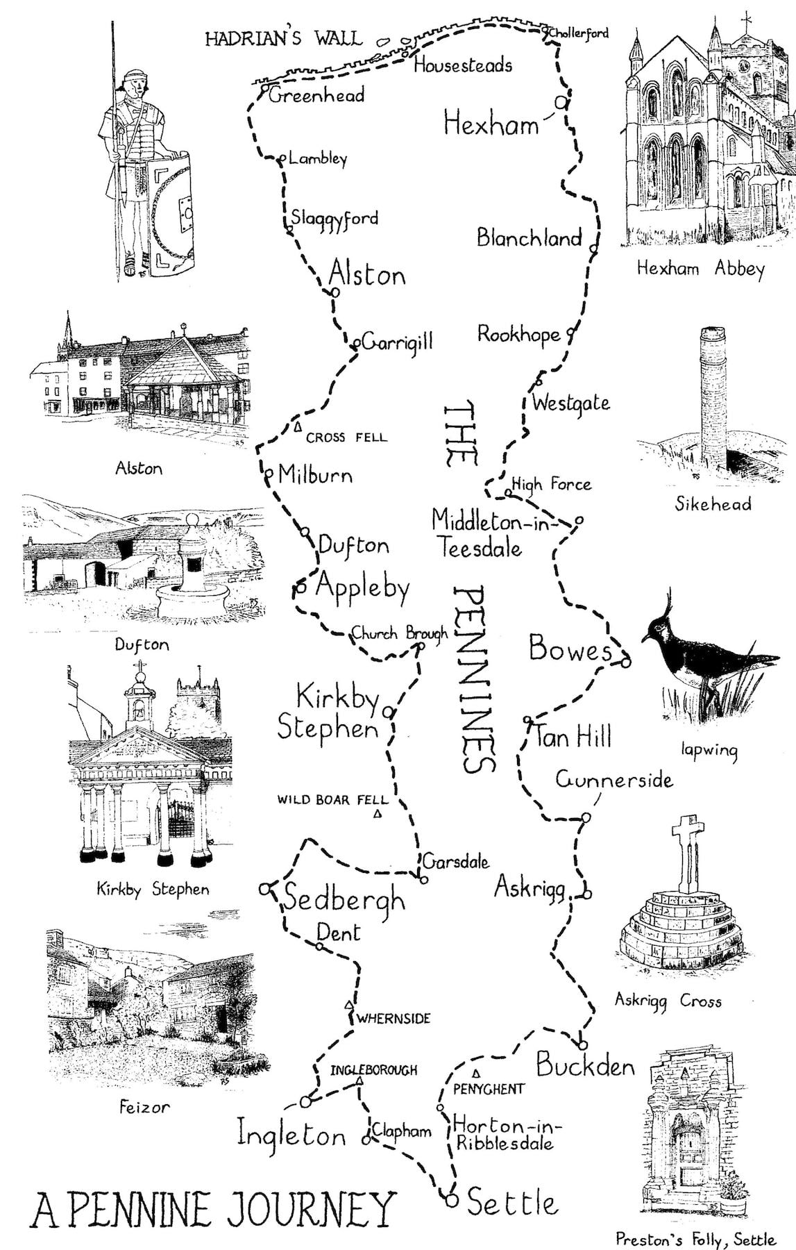
Ron’s route map, following the modern ‘A Pennine Journey’
The varying route descriptions were edited into a common format and were merged with the illustrations and route maps into what the publishers Frances Lincoln described as a ‘pictorial guide’ – an accolade that delighted me and Heather, as this description had hitherto only been used for AW’s guides! Over 40 members and friends were present at Settle station for its launch on a perfect day for walking in April 2010.
Then followed the work needed to make this a tangible tribute to AW, starting with the creation of a website with, importantly, an accommodation register so that walkers could plan their own journey. Soon Brigantes Walking Holidays set up a baggage courier service, funds were raised from guide book sales, the endorsement of all the highway agencies along the route was obtained – and by the 75thanniversary of AW’s 1938 walk the entire route had been waymarked. The next step was to get the route onto Ordnance Survey maps, especially given AW’s love of the work of the Ordnance Survey – “I admire their work immensely, being lost in admiration of all their work. Their maps are, as ever, my favourite reading.” By February 2016 the route was on all relevant Explorer and Landranger maps and to a large degree this tribute to Alfred Wainwright could be said to be complete.
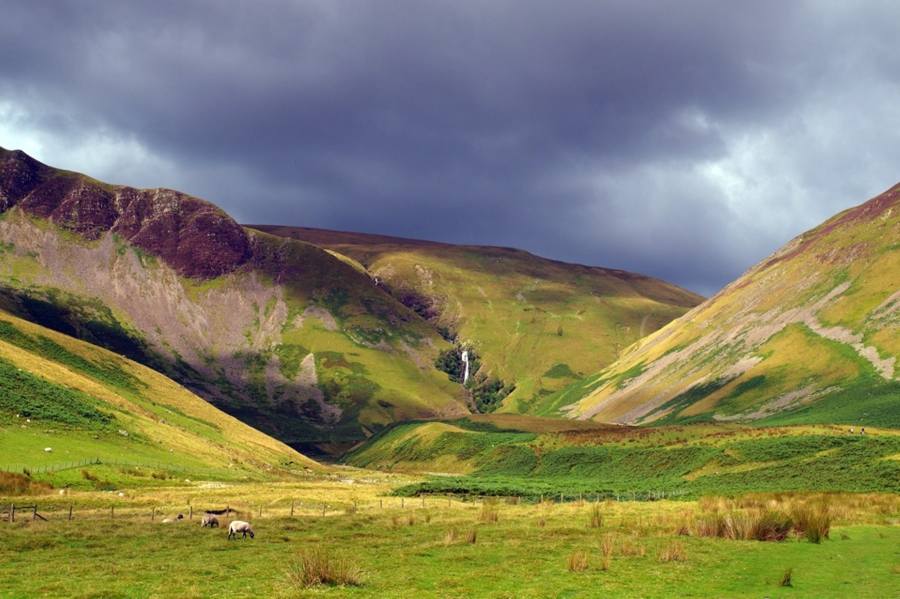
AW’s careful planning nearly 80 years ago means that it traverses some of the most delightful walking terrain in northern England: savour delightful river valleys, high fells and wide expanses of moorland; be fascinated by the historic places on its route, with the World Heritage Site of Hadrian’s Wall pre-eminent; and enjoy the hospitality of the towns and villages along the way.
This latest testimonial came from a young lady who walked the route last year with her grandparents and raised over £4000 in sponsorship for an outdoor classroom for street children in Kenya. “The walk covered a wide range of different terrain and scenery and every day was amazing… I would recommend the walk to anyone who wants to see, in a comparatively short space of time, a large part of the magnificent range of scenery that northern England has to offer. It really is a beautiful walk…”
Recently it was described as “Bigger than the Coast to Coast, more beautiful than the Pennine Way: discover the incredible trail that’s Wainwright’s greatest gift to walkers”. Is it true? The only way to find out would be for you try it!
penninejourney.org.uk


