This is a paid partnership with our friends at Discover Carmarthenshire. This tourism initiative is jointly funded by UK Government Levelling Up Fund and Carmarthenshire County Council.
From Carmarthen Bay to the western Brecon Beacons, Carmarthenshire in South West Wales is full of epic mountains, breath-taking vistas and a crystalline coastline that peeks across to Pembrokeshire and the Gower.
You could look at Carmarthenshire as a kind of microcosm for the whole of Wales. It has a coastline with sweeping beaches and sand dunes, verdant countryside with an egg-box-like topography, mountains, valleys, ancient market towns, rivers that range from the white-watered and boulder-filled to the meandering, and of course, there are castles in every corner.
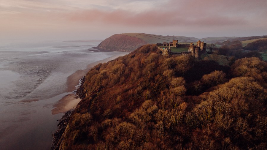
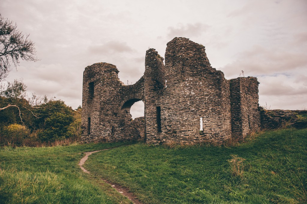
Main image: Llansteffan Castle. Credit: Discover Carmarthenshire
Unsurprisingly then, this section of southwest Wales makes for fine walking country. Head west if it’s more of a countryside ramble that you’re after – a pub-to-pub route, perhaps – or go south if you’re in search of some sea air. Up north, the county touches upon the fringes of the Cambrian Mountains, while things get especially wild over on the eastern edge where the Carmarthen Fans, part of the Brecon Beacons National Park, form a landscape of high places.
Here is a mix of coastal and rural routes for exploring this walker-friendly county and the towns that make perfect launchpads this winter.
Discover Carmarthenshire’s coastal walks
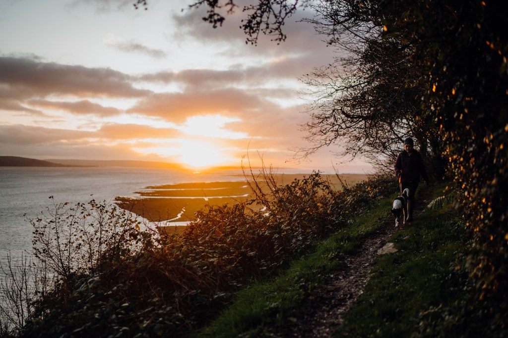
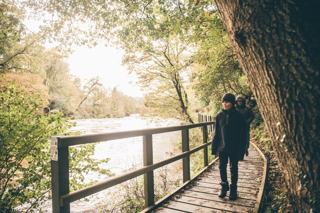
Llansteffan
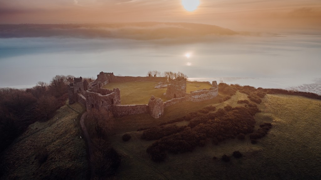
The sun sets on Llansteffan Castle. Credit: Discover Carmarthenshire
Even by Welsh standards, Llansteffan castle is spectacularly sited on a craggy promontory at the mouth oh the river Tywi, with panoramic views over the estuary mouth to the Gwendraeth Estuary, Pembrey Forest, Cefn Sidan beach and across the Gower and Worm’s Head. The castle stands guard over the village and the estuary, as it has since it was built by the invading Normans in the 12th century. Destroyed and rebuilt at least three times, it is now under the care of CADW and is open to the public.
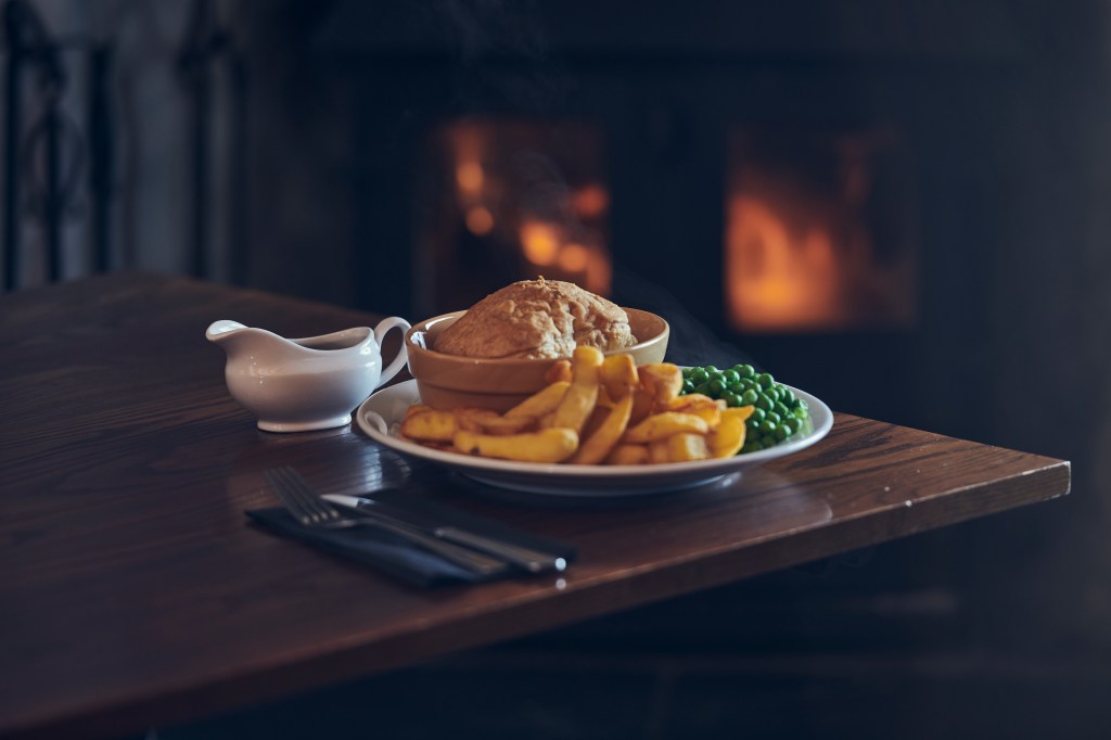
Enjoy delightful coastal walking taking in this imposing Norman Castle with staggering views across Carmarthen Bay and St Anthony’s well with its water reputed to cure many ills. Along the way lies the quiet, secluded, golden sands of Scott’s Bay. Afterwards, treat yourself to a delicious meal at Sticks.

The offerings to be had at The Sticks, Llansteffan. Credit: Discover Carmarthenshire
Walks in this area combine fabulous coastal scenery with lovely country lanes. The paths are usually of a gradual gradient and easy to follow, often skirted by flower rich hedgerows.
A short walk to St Anthony’s Well, (along the beach if the tide is out) and back along the cliff top path, taking in the castle, is approx. 3km (1.8 miles) long with 62m (203ft) of ascent. A medium walk to St Anthony’s Well and continuing along the Wales Coast Path to Lords Park and a return via the cliff top path is approx. 5.6km (3.4 miles) long with 144m (472ft) of ascent.
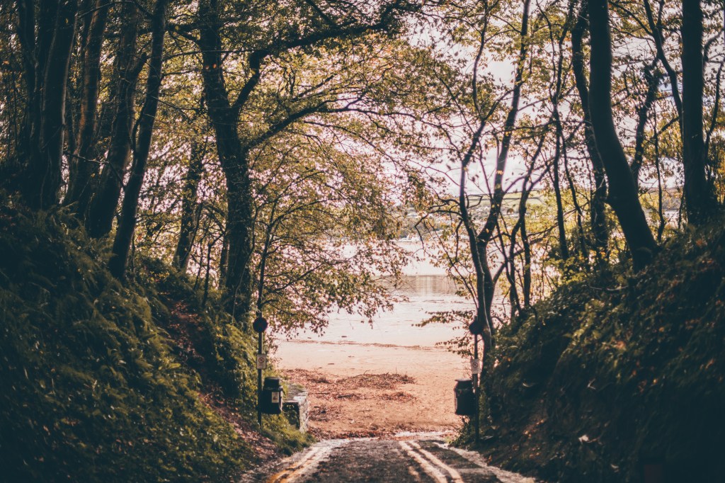
Walking through the trees to shore. Credit: Discover Carmarthenshire
For a good long walk, follow the outer circle of the recommended routes. This is 7.7km (4.7 miles) long with 210m (688ft) of ascent. Please note that sections of the walks can be muddy in places even in summer. Good walking footwear is recommended.
Discover more walks in Llansteffan.
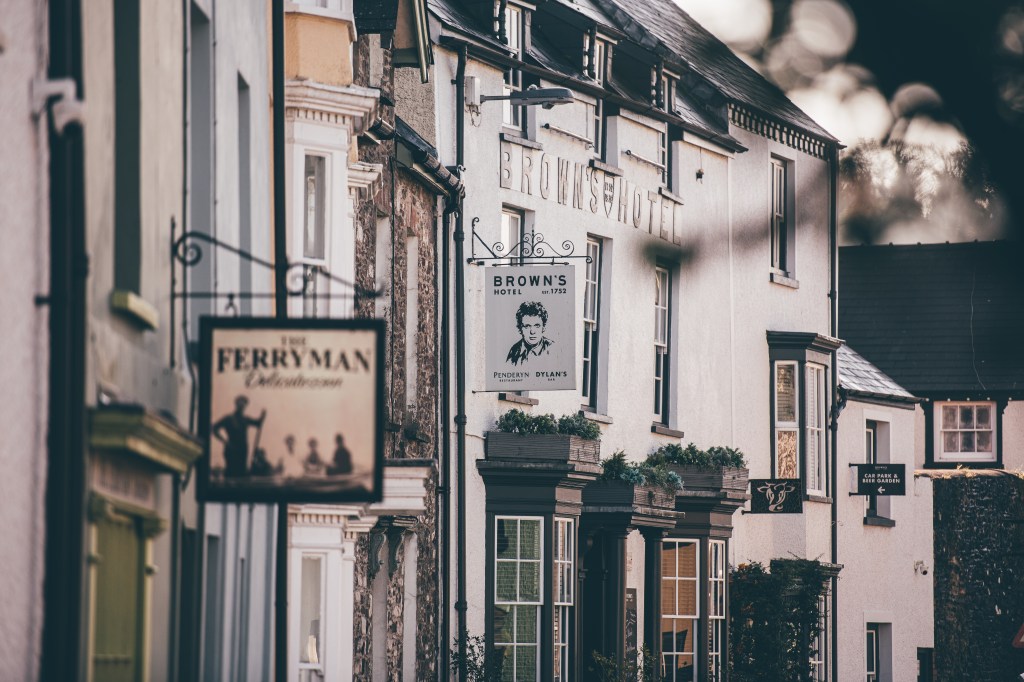
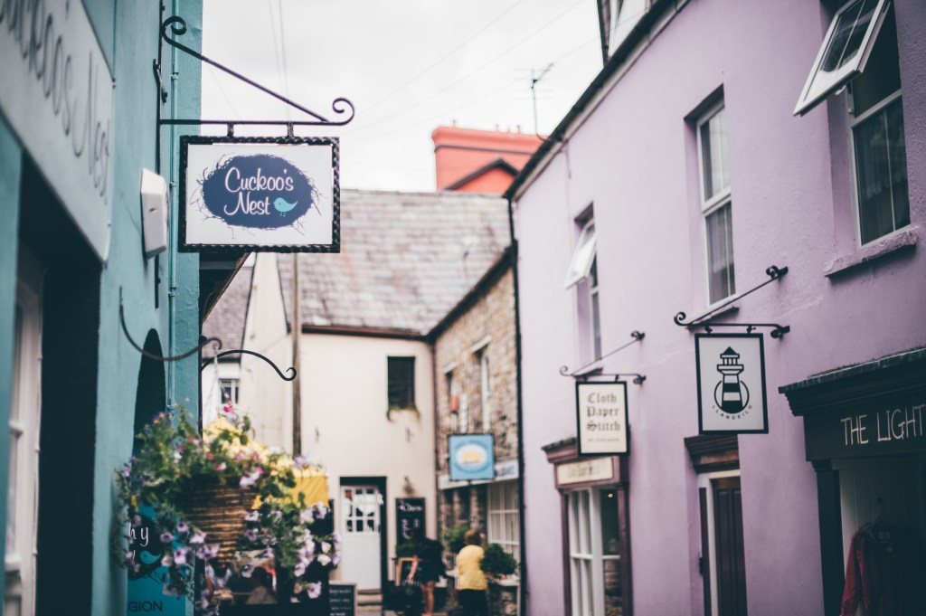
Laugharne
Sunset over Carmarthen Bay. Credit: Discover Carmarthenshire
Laugharne has been a source of inspiration to poets and artists for a long time – not least William Turner, whose watercolour of Laugharne Castle shows a rough sea over the Grist with people salvaging wreckage. So Dylan Thomas is but part of a long tradition. It is also home to two fine walking routes.
Dylan’s Walk – 4.6km (approx. 3 miles) – to the north east is over relatively level ground for most of the way. The route is surfaced as far as Dylan Thomas’s writing shed and Boat House. Further along there are fields and short uphill sections on rough farm tracks. Sir John’s Hill walk – 2.6km (just over 1½ miles) – is hillier in nature, with a short flight of steps, grassy tracks, fields to cross and a short section of country lane. St John’s Hill walk is 2.6 Km (just over 1½ miles). For afters, food at The Three Mariners comes highly recommended.

The grub at Three Mariners, Laugharne. Credit: Discover Carmarthenshire
There are information panels at viewpoints points along the way and sections of both walks follow the Wales Coast Path which provides breath-taking views across the bay. Both walks have strong associations with Dylan Thomas.
For other points of interest, Laugharne Castle was first established in 1116 but the towering walls date to the 15th and 16th centuries as a fortified country house.
Laugharne town. Credit: Discover Carmarthenshire
The salt marshes have developed in area over the last 100 years or so – in the Middle Ages, boats could come right up to the castle walls. You can also visit St Martin’s Church which dates back to the 13th century. Dylan Thomas is buried in the new graveyard, marked with a simple white crucifix.
Discover more walks in Laugharne.
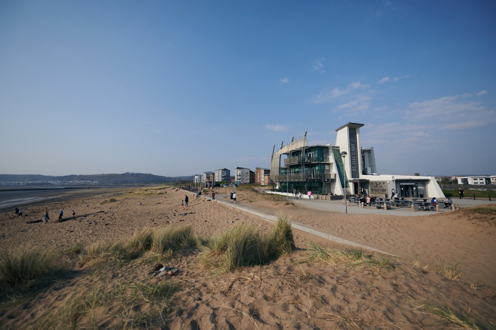
Millennium Coastal Park
At the Millennium Coastal Park. Credit: Discover Carmarthenshire
A beautiful part of the award winning Millennium Coastal Park taking in the views of Gower, this traffic free path is ideal for buggies and wheelchairs and has adjacent car parking. The Millennium Coastal Park was opened on the Millennium and regenerated the coastal area of Llanelli, which until recent memory was an industrial landscape of numerous steel and tinplate works. Now the land is pleasant and green.
You’ll find black rocks along the your chosen walking route. These are the waste from the steel furnaces, look at them closely and you’ll see that they are full of bubbles from when they were liquid inside the blast furnaces.
For something more appetising, try Hwyl.

Hwyl, Llanelli. Credit: Discover Carmarthenshire
You can follow National Cycle Route 4 along a super traffic free path which passes along the beautiful Loughor estuary and the Gower peninsula. The route takes you past Llanelli beach and Tywyn beach to Burry Port where you will find a pretty harbour, beach, and the newest marina in Wales. Heading east passing Sandy Water Park and Machynys beach before coming to the National Wetlands Centre where you can look out for a variety of sea and water birds such as flocks of dunlin, ringed plover, sanderling, and redshank along the coast whilst shelduck, oystercatcher and curlew can be seen further out on the mudflats and not forgetting the Swans on Sandy Water Park. In the summer you can spot orchids and other wildflowers.
Discover more walks at the Millennium Coastal Park.
Discover Carmarthenshire’s rural walks
Newcastle Emlyn & Cenarth
Newcastle Emlyn. Credit: Discover Carmarthenshire
This trail connects two of the Teifi valley’s most historic settlements, Cenarth and Newcastle Emlyn, passing through attractive countryside along the southern edge of the Teifi floodplain. It follows an old roadway, possibly the route followed by the army of Owain Glyndwr in June 1403 on its way to attack the castle of Newcastle Emlyn, having crossed the river near Cenarth.
It’s a pretty village on the banks of the Teifi, renowned for its spectacular waterfall and salmon fishing. The traditional coracle is still used by fishermen on the river. Although small, the village is packed with buildings and places of great historical interest, including the parish church, which has origins going back over 1000 years, and a motte and bailey castle, built here in the 12th century to guard the river crossing.
Cenarth board walk along the river Teifi. Credit: Discover Carmarthenshire
Newcastle Emlyn owes its foundation and its name to the castle built by Maredudd ap Rhys Grug in 1240 to establish his control of the lordship of Emlyn Uwch Cych. The castle, the ruins of which can be seen on the banks of the Teifi, was involved in some of the most dramatic events in Welsh history. It was a final stronghold of the last native prince of West Wales, Rhys ap Maredudd (a son of the castle’s builder), who was executed here in 1292.
In 1403, the castle was captured by Glyndwr’s men during his War of Independence. It was finally blown up by Cromwell’s forces after the end of the Civil War in 1648. Throughout those troubled centuries, the town survived and during more peaceful times grew into an important centre of local trade and commerce. Today, Newcastle Emlyn is a busy market town with many places of interest, from shops and inns to its church, chapels, and other public buildings.
Three Horseshoes at Cenarth. Credit: Discover Carmarthenshire
A linear path along green lanes links these villages. Most of the route is over gently undulating ground with only a couple of short sections of moderately steep ground. The walk – 5km (3 miles) – is not particularly difficult but once you’ve walked between the two towns, seek out some sustenance at the Three Horseshoes.
Discover more walks in Newcastle Emlyn & Cenarth.
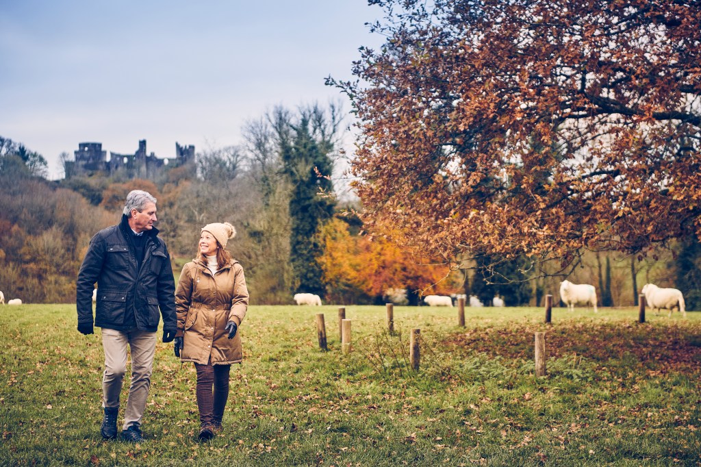
Llandeilo
Walking at Llandeilo. Credit: Discover Carmarthenshire
This area has a fascinating history and has been associated with military, political, religious and commercial power for over 2000 years. The walks visit all the key sites in its long and dramatic story, which includes the histories of the three borough towns that once stood in this area – Llandeilo Fawr, Dinefwr (near Dinefwr Castle) and Newton (near the present Newton House).
But no trip to Llandeilo is complete without a walk around Castell Carreg Cennen. In May, you can enjoy the spectacle of Castle Woods in a carpet of Bluebells. The many paths within the estate allow for long, medium or short walks.
In Llandeilo town. Credit: Discover Carmarthenshire
The outer circular walk within Dinefwr Parkland is approximately 6km long over mixed terrain. Most of the paths within the park are of a reasonable gradient, many of which are surfaced and ideal for the less able walker, or those wanting a gentle stroll. Steep sections are few and can often be avoided. The northern route is mostly unsurfaced paths through fields.
Discover more walks in Llandeilo.
RSPB Gwenffrwd Dinas, Rhandir-mwyn
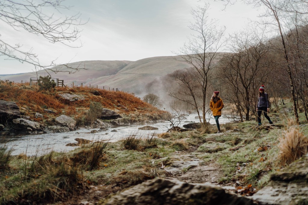
A Rhandirmwyn walker enjoying the misty morning. Credit: Discover Carmarthenshire
This very beautiful walk around the RSPB Gwenffrwd/Dinas Nature Reserve is set in a quiet unspoilt part of Carmarthenshire. Half of the recommended route is over rough terrain, but the remainder is accessible to most visitors. The boardwalk section gives good access to Alder woodland, beyond the boardwalk are ancient Oak woodlands and the upper River Tywi. The entire walk is 3.2km (2 miles) long and has 104m (341ft) of ascent and descent.
There are plenty of pubs in the town of Llandovery so work up an appetite out of doors.

Pies a-plenty at the Castle Hotel Llandovery. Credit: Discover Carmarthenshire
This RSPB managed reserve is a delight for anyone not only bird watchers. Four characteristic species of birds are to be found in summer in these upland oak woods – Pied Fly Catchers, Wood Warblers, Tree Pipits and Red Starts. The area was the last stronghold of the Red Kite, (once persecuted almost to extinction in Great Britain) they are regularly seen in this area now along with Peregrine Falcons and Buzzards.
Much of the route adjacent to the river Tywi and is rugged, uneven, rocky and slippery in places when wet. It is recommended that this section is best attempted by those who are able bodied and used to rough hill walking.

In Llandovery town. Credit: Discover Carmarthenshire
The approach from Llandovery alongside the River Tywi is delightful and the charming villages of Rhandir-mwyn and Cilycwm have pubs, cafes and a post office.
Discover more walks in Rhandirmwyn.
Walking in Carmarthenshire allows you to appreciate the striking difference of the changing seasons on the natural landscape whilst take your pick from charming market towns that are full of independent shops, coffee roasteries and pubs all offering the best local produce. Not only is it incredibly easy to reach (at the end of the M4!), but Carmarthenshire also offers a range of boutique hotels and country cottages stays – each bountiful in warm Welsh hospitality.