Andrew Galloway crosses a river in Snowdonia then crosses it again on this Dyffryn Ardudwy hike via Moelfre.
Llyn Bodlyn, a lake at the head of the valley of Dyffryn Ardudwy, was enlarged in 1894 to supply the seaside town of Barmouth with water. It is the source of the Afon Ysgethin. In its short journey to the sea the river passes beneath two bridges of historical significance. The first is Pont Scethin, a stone packhorse bridge dating from the eighteenth century. The second is Pont Fadog, a single arch road bridge of masonry construction, more or less concealed within the wooded gorge of the river. A slab of stone on the parapet of the bridge is notably inscribed with the year 1762 and the initials WV, standing for William Vaughan, the wealth inhabitant of nearby Cors y Gedol hall and benefactor of the eighteenth century structure. Among a glade of Howthorn trees, not four hundred meters from the bridge, stand the ruins of a Neolithic burial chamber. Covered in sun-bleached lichen, these stones may be the final resting place of the ancient ancestors of William Vaughan.
Dyffryn Ardudwy: route description
Start/Finish: Car Park by Tal-y-bont Bridge on the A496 Harlech to Barmouth Road. GR: SH589218 | Distance: 15.5 km (9.6 miles) | Ascent: 600m Time: 5 hours | Maps: Ordnance Survey 1:25,000 OL18 Harlech, Portmadog & Y Bala
1. SH589218: From the car park at Tal-y-bont Bridge take the path on the north bank of the river eastwards, passing the Ysgethin Restaurant. Continue along the path through the sessile oak trees of Coed Cors-y-gedol for 1.8km to where a minor road crosses the river.
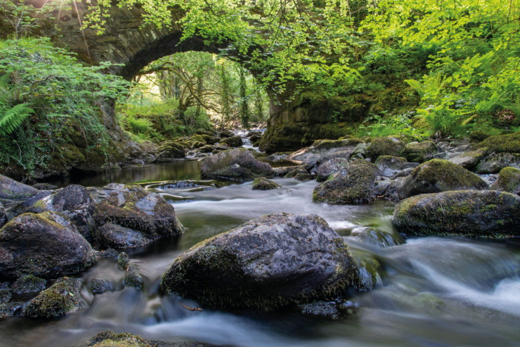
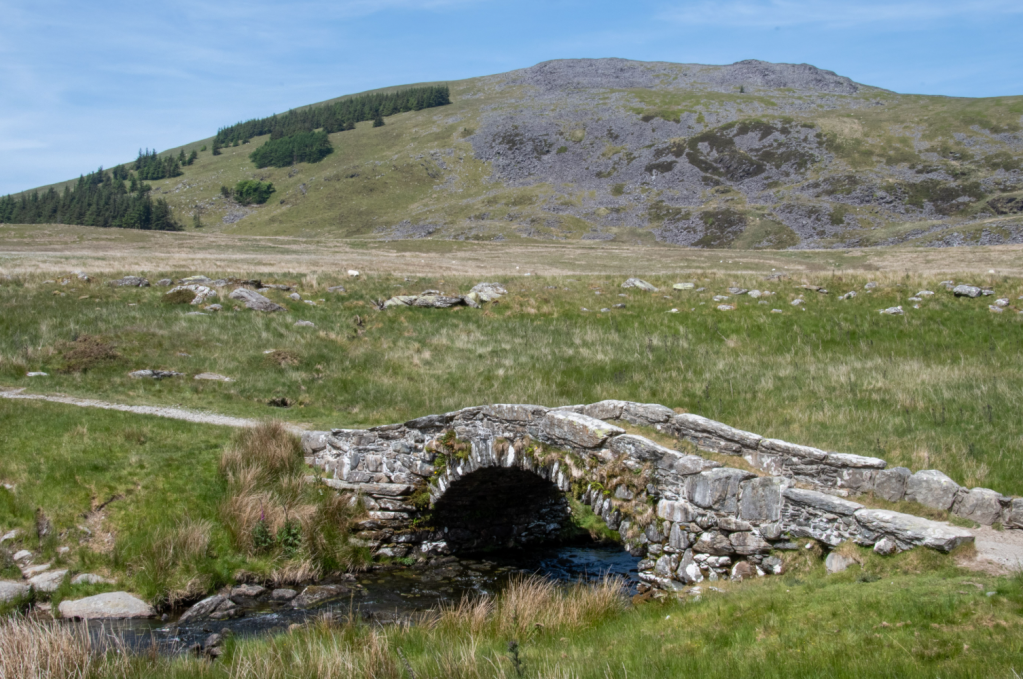
Pont Fadog, Dyfrryn Ardudwy. Credit: Andrew Galloway
2. SH606226: Pont Fadog is 50m to the right. Do not cross the bridge just yet. Rather turn to the left and follow the road for 700m passing the remains of a Neolithic burial chamber on the left.

Burial Chamber, Cors y Gedol. Credit: Andrew Galloway
3. SH602230: At the junction turn left to catch a glimpse of Cors-y-Gedol Hall, the sixteenth Century manor house of the Vaughan family. Sadly the property is not open to the general public, although it is available to hire for private functions. Return to the junction. Take the rough track due east for 2.4km to where it intersects with the route of the old Harlech to London Road.
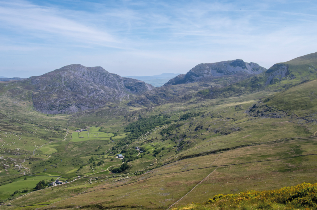
The Rhinog Mountains _ Cwm Nantcol from Moelfre. Credit: Andrew Galloway
4. SH622237: A gate gives access to open moorland. Ascend the steep grassy slope northwards for 900m towards the summit of Moelfre, passing to the right of a cluster of stone ruins. Where a wall intersects with a wire fence, cross the ladder stile. The summit cairn of Moelfre lies 200m to the east. Standing at 589m, Moelfre is a modest hill in the Rhinogydd range with a grassy, flattened top prone to bogginess. Perhpas wise to wear the gaiters on today’s outing.
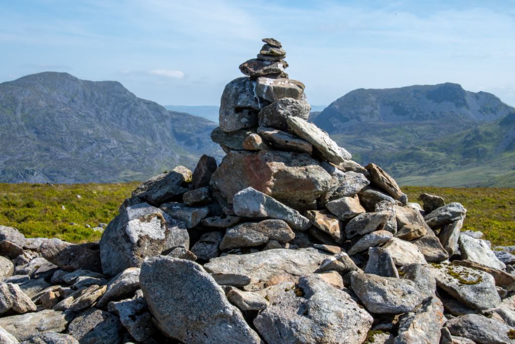
Cairn on Moelfre with Rhinog Fawr and Rhinog Fach in the distance. Credit: Andrew Galloway
5. SH626245: Head due south and cross the wall by means of another ladder stile. Turn immediately to the left and follow the wall due east, taking care as the first 300m of the descent are steep and rocky. Sharp rocks soon give way to smooth grass. Continue eastwards for a further 800m to the saddle between Moelfre and Moelyblithcwm. Here a path joins from the north.
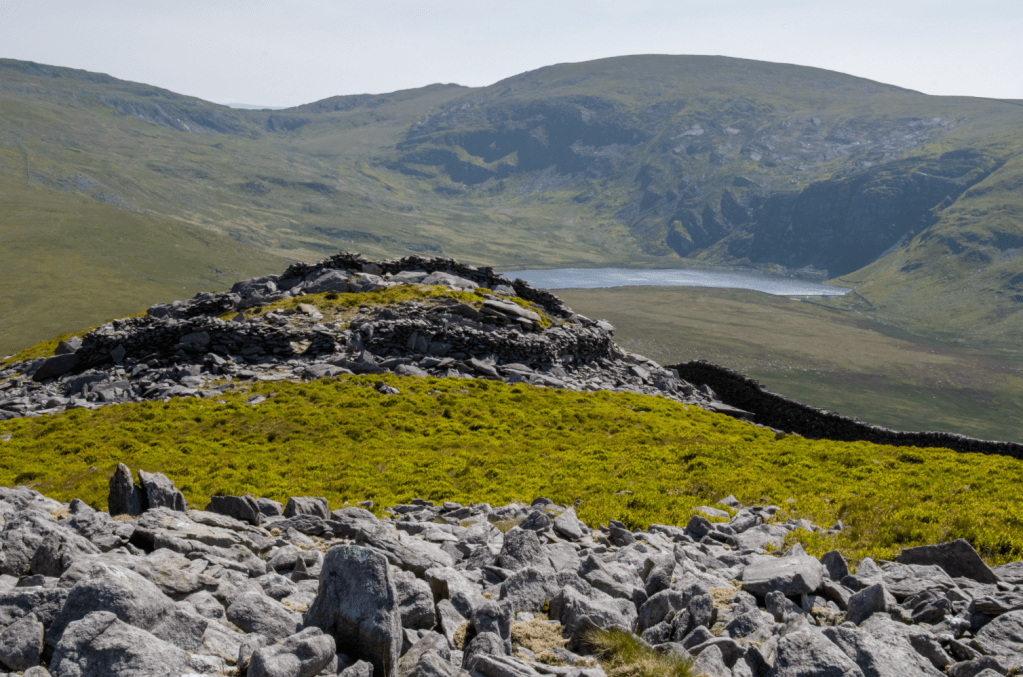
Enclosure on Moelfre with Llyn Bodlyn. Credit: Andrew Galloway
6. SH637246: In the valley below a rough track provides access to the Llyn Bodlyn reservoir. Walk southwest for 800m to arrive at this track. Take the track to southwest for 600m to where it meets the route of the old Harlech to London Road. Turn to the left and follow the route of the old road for 700m to reach Pont Scethin, an ideal spot for refreshments. Located in isolation of any dwellings, this bijou little bridge is the crossing point of the old Harlech to London Road, the route of which was most likely established as far back as the construction of Harlech Castle in the late thirteenth century.
Pont Scethin. Credit: Andrew Galloway
7. SH634235: On the far side of the bridge motor vehicles have worn the course of the old road into unsightly ruts. After 300m a narrow path branches away towards the south-west. Follow the path for 700m to a field gate. Continue along the path for 3km, passing to the north of Llyn Irddyn, eventually arriving at Pont Fadog, a single arch road bridge of masonry construction, more or less concealed within the wooded gorge of the river. A slab of stone on the parapet of the bridge is notably inscribed with the year 1762 and the initials WV, standing for William Vaughan, the wealth inhabitant of nearby Cors y Gedol hall and benefactor of the eighteenth century structure.
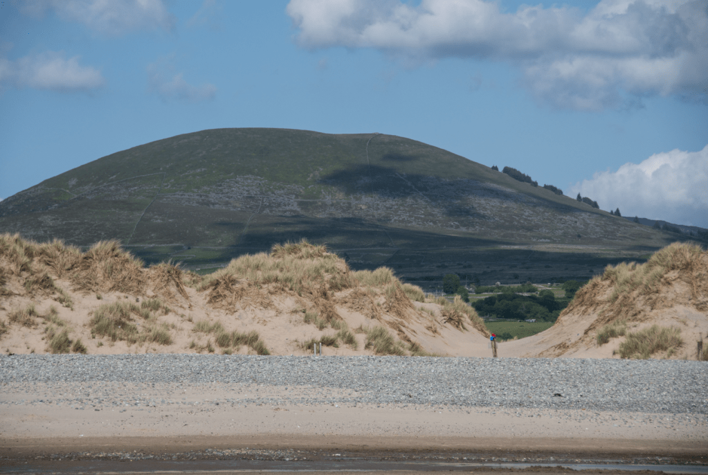
Moelfre from the sand dunes at Morfa Dyffryn. Credit: Andrew Galloway
8. SH607225: Head up the lane for 100m then take the footpath through Coed Cors-y-gedol, beside Afon Scethin, for 2km back to Tal-y-bont
Further information
Public Transport: Tal-y-bont station is on the Porthmadog to Barmouth railway line. Trains leave Porthmadog approximately every two hours on weekdays. For further details check www.avantiwestcoast.co.uk
Information: snowdonia.gov.wales