It’s wet, wet, wet in the Lakes as Vivienne Crow discovers on a hike up to Styhead and Sprinkling Tarns.
Is it an understatement to say that water is an important feature of the Lake District? Maybe it’s stating the obvious; after all, the name of England’s largest National Park is the first clue. Then there are the becks, the rivers, the waterfalls… We’ve got a lot of it coming out of the sky too and keeping the peatlands boggy and just generally lying about in puddles on the ground. For me, the best ‘puddles’ are the tarns: from tiny pools sparkling like wet jewels on high, lonely ridge tops, to small lakes sitting cold and moody (and wet) at the base of sombre cliffs. For the drama and grandeur of their settings, Styhead and Sprinkling Tarns are among the most spectacular of these bodies of water. At about 440m above sea level, Styhead Tarn sits at the base of Great Gable, with the fearsome eastern face of Lingmell looming nearby. Higher still, Great End’s mighty buttresses tower over Sprinkling Tarn, a serene body of water renowned for being the wettest place in the country. More on that later…
Styhead and Sprinkling Tarns via Grains Gill: route description
START/FINISH: National Trust pay-and-display car park at Seatoller, Borrowdale, GR NY245137 | MAPS: OS Explorer OL4 and OL6 (1:25k), OS Landranger 89 or 90 (1:50k), Harvey 1:25,000 Superwalker Lake District West | DISTANCE: 13.9km/8.6 miles | ASCENT: 579m/1900ft | DURATION: 4 hours
1. NY245137: Leave the car park, turn left along the road and then take the lane on the right. After 1.1km, go through the gate on the right – just before the bridge over the River Derwent. The path soon heads upstream beside the river. Occasionally, at this time of year, the bed of the river is dry here, making it hard to believe this is the same Derwent that has contributed to repeated and often devastating floods further downstream in Keswick and Cockermouth. Cross the footbridge over Sour Milk Gill and immediately turn left to cross the gated bridge over the Derwent.

In the upper reaches of the River Derwent during a dry spell, summer of 2023. Credit: Vivienne Crow
2. NY235121: Reaching the cobbles in front of the cottages at Seathwaite, turn right. Drawing level with the far end of the barns, continue straight ahead on the main valley track, ignoring another track to the left early on.
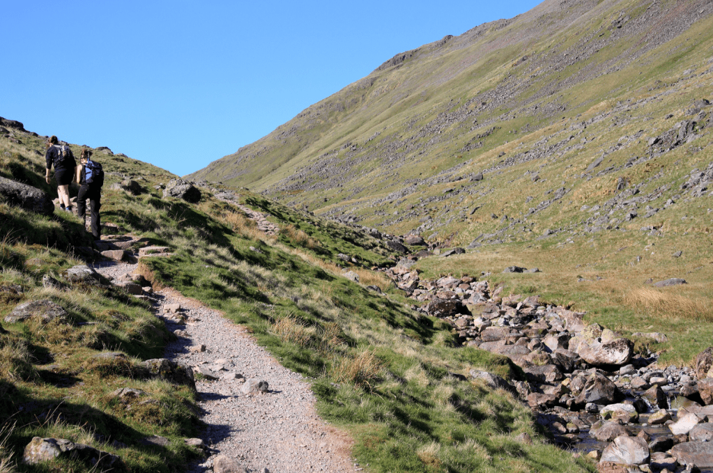
On the steady ascent towards Sty Head. Credit: Vivienne Crow
3. NY234109: After crossing Stockley Bridge, go through a gate in a wall and keep to the well-trodden path heading uphill. Later crossing a footbridge over Styhead Gill, the path then passes around the western side of Styhead Tarn. If you’re here early or late in the day, there will probably be tents pitched at the water’s edge, wild-campers enjoying the spectacular surroundings.
Styhead Tarn. Credit: Vivienne Crow
4. NY218095: On reaching the Mountain Rescue stretcher box at Sty Head at the foot of Great Gable, turn left. Keep left as the Corridor Route to Scafell Pike heads off to the right. The stony path climbs at a moderate angle to reach Sprinkling Tarn. The route really only brushes up against the water’s edge, but it’s worth going off piste to have a wander around.
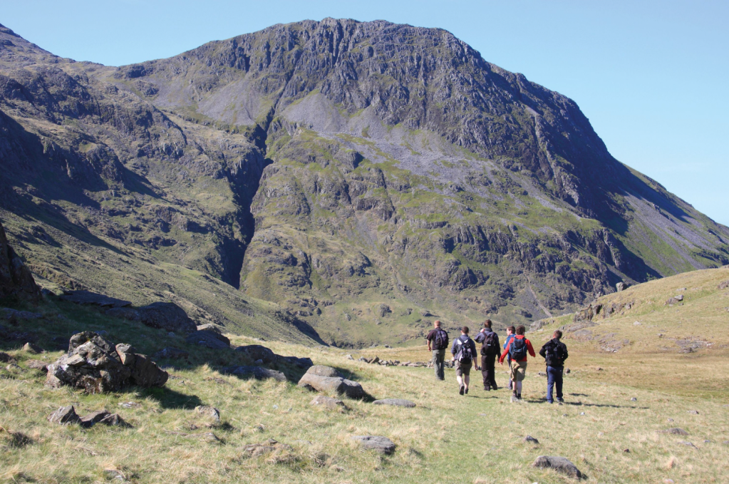
With Lingmell looming, a group of walkers heads off along the Corridor Route. Credit: Vivienne Crow
The tarn is cradled by the many lumps and bumps of Seathwaite Fell, an area that is dotted with tiny pools glinting in hollows or hidden from view by encircling crags. With dramatic views of the surrounding mountains, it’s an excellent spot for lingering… when it’s not raining, of course. (Sprinkling Tarn holds the record for the highest annual rainfall in the UK: 6527mm in 1954.) Having explored, continue on the main path climbing beyond the tarn and passing below the gullies that dissect Great End’s north face.

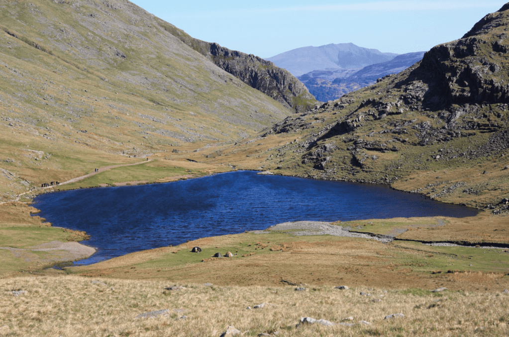
Sprinkling Tarn. Credit: Vivienne Crow
5. NY229086: About 500m beyond Sprinkling Tarn, as the rock beneath your feet turns red, cross the gill to the left. Follow Ruddy Gill and then Grains Gill downstream on a clear path, with the slopes of Seathwaite Fell up to your left at first. If you’re not too tired of the watery theme by now, you’ll enjoy the descent, accompanied by Grains Gill’s many waterfalls and plunge pools.
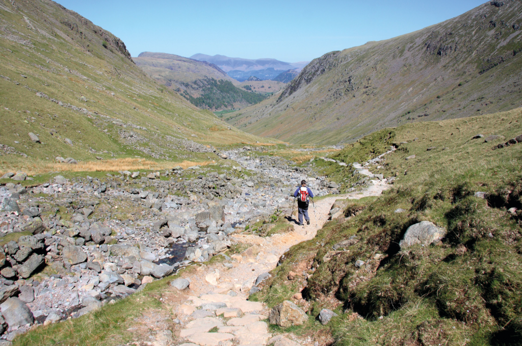
Descending beside Grains Gill. Credit: Vivienne Crow
6. NY234099: Grains Gill is eventually crossed via a narrow wooden bridge. Turn right at the next path junction, going through a gate to recross Stockley Bridge at waypoint 3. Return to Seathwaite. (Please forgive me one last mention of the theme, but Seathwaite holds the record for the highest rainfall in a four-day period: 495mm in November 2009. We don’t like to brag about it too much, but the Lake District holds a number of other UK rainfall records too. The award for wettest 24-hour period goes to… Honister Pass for Storm Desmond in December 2015. Wettest two-day period? Thirlmere. Okay, okay, I’m going to shut up now.) From waypoint 2 at Seathwaite, either retrace your steps through the gap between the farm buildings and then along the riverside path, or follow the lane all the way to the main Borrowdale road at Seatoller.
Further information
PUBLIC TRANSPORT: Bus 78, Keswick to Seatoller, and the seasonal 77/77A, Honister Rambler (www.stagecoachbus.com)
TOURIST INFORMATION: www.lakedistrict.gov.uk, 0845 9010845