Alex Roddie goes looking for the refreshment of sparkling mountain water on a hot day, and finds it on the way up (and down) Lochnagar.
Did you know that Lochnagar was not originally the name for the mountain? Lochnagar is actually the name of the jewel-like loch held in the Corrie of Lochnagar. It’s thought that the mountain itself was originally called Beinn Chìochan or Beinn nan Cìochan, but the name Lochnagar eventually stuck. As mountain walks based around water go, this one has several points of interest. You’ve got the River Muick on the first stage. There are the bewitching deep waters of Lochnagar. Then, on the descent, you’ll come to the Falls of the Glasallt – one of the most attractive waterfalls in the area, and a lovely spot on a hot day. Finally there is Loch Muick, a large loch on the final stage of the walk. This is a cracking route up a cracking mountain – arguably the best in the entire Southern Cairngorms, and certainly the most rugged. And with good paths throughout and a starting elevation of around 400m, it isn’t too strenuous – although it’s still a Scottish mountain walk with everything that entails.
Lochnagar: route description
START/FINISH: NO310851, Spittal of Glenmuick car park S of Ballater | MAPS: OS 1:25,000 Explorer sheet OL53 (Lochnagar, Glen Muick & Glen Clova), OS 1:50,000 Landranger sheet 44 (Ballater & Glen Clova), Harvey 1:40,000 British Mountain Map (Cairngorms & Lochnagar) | DISTANCE: 19km / 11.8 miles | ASCENT: 908m / 2,979ft | DURATION: 6 to 7 hours
1. NO310851: Cross the bridge and head SW on the clear track, which soon enters a stand of trees near estate buildings. At a T-junction, take the right-hand (NW) fork running alongside the left edge of the trees. This broad, largely flat track crosses moorland in the bottom of the glen. After a few hundred metres there is a bridge across the River Muick, where new trees have recently been planted. Continue along the track to Allt-na-giubhsaich (private estate bothy and several other buildings).
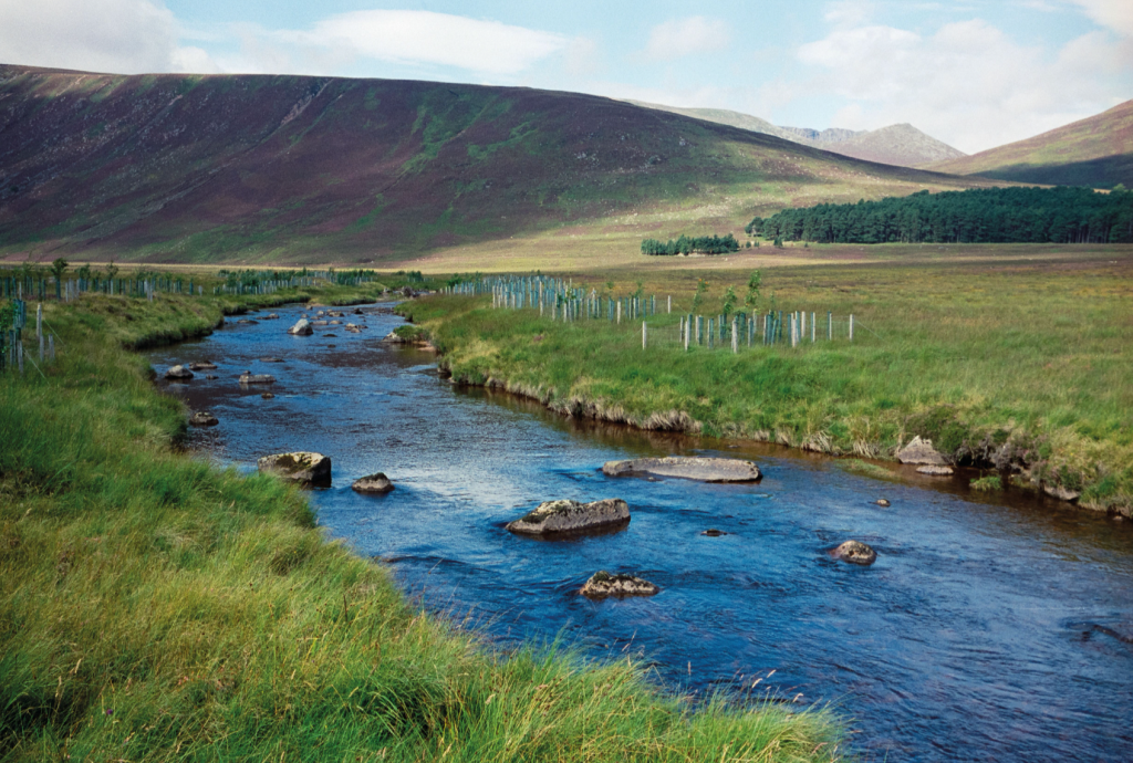
Newly planted trees beside the River Muick. Credit: Alex Roddie
2. NO298858: Take a path through woodland on the left bank of the stream, which soon begins climbing gently uphill. The path leaves the woodland after about 0.3km and, about the same distance further on, crosses a minor ford to the other side of the stream (crossing unlikely to be challenging except after heavy rain). The clear track continues to ascend on the N bank of the burn, passing an area of old shielings. Climb for about 2.3km and 200m of ascent from the ford to reach a junction at a broad bealach (678m).
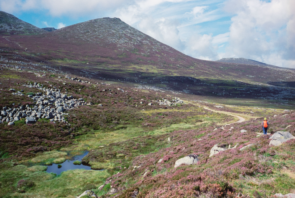
At the path junction where the ascent towards Meikle Pap begins. Credit; Alex Roddie
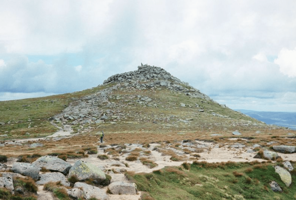
3. NO274861: Take the left fork. After a short descent, the route resumes its uphill climb, and areas of boulders protrude through the heather moorland. The climb is steady for the most part – until a final steeper pull up to the bealach (917m) between Meikle Pap and Cuidhe Crom.
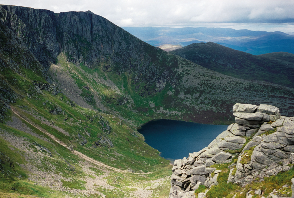
The loch Lochnagar glittering in the Corrie of Lochnagar. Credit: Alex Roddie
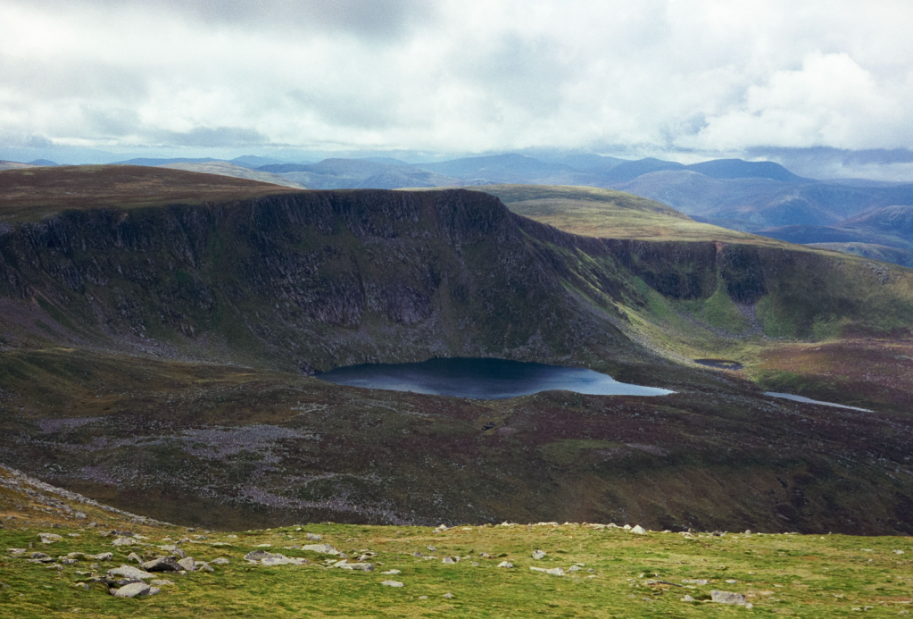
4. NO259858: The surprise view from this bealach is one of the highlights of the route. Suddenly you get a full-frontal dose of Lochnagar in all its glory – a wild place even on a sunny day. Climb due S on a path that soon begins to thread a route through a steep boulder field, and after 161m of ascent reaches a broad top (1,078m). The views continue to develop as you head around the corrie rim.
The final ascent to the summit. Credit: Alex Roddie
5. NO254852: At a bealach (1,045m) the path forks. While the main route keeps going, taking a gently rising contouring line away from the cliff edge, another trail climbs more directly along the top of the summit cliffs. If taking the main path, continue to a junction at NO248852 and then turn right, climbing directly towards the top of Cac Carn Mor. Shortly after this, at a a dramatic view down a gully, the clifftop route converges with the main path. Here the final ascent to Lochnagar’s summit is visible.
Views SW towards The Stuic. Credit: Alex Roddie
6. NO244861: The view from Lochnagar’s rocky summit is extensive, with perhaps the most interest to the SW, towards The Stuic and Loch an Eun. Return the way you came, back over Cac Carn Mor to reach the path junction at NO248852.
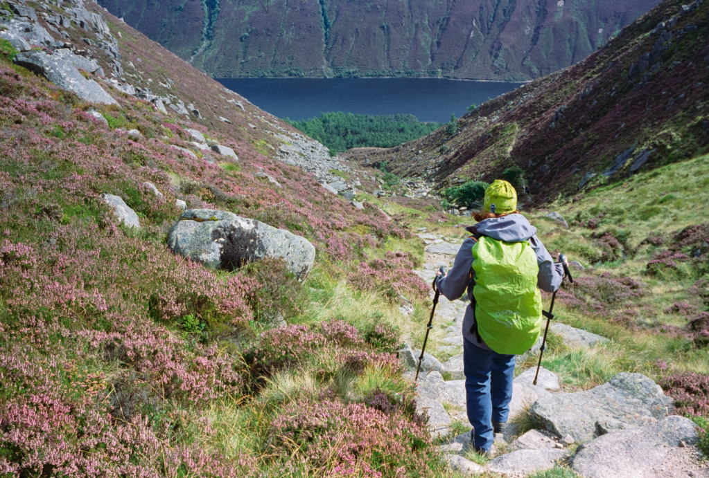
The steep descent towards Glas-allt-Shiel. Credit: Alex Roddie
7. NO248852: Keep descending on the clear path following the Glas Allt. After about 2.5km it crosses the stream via a footbridge, then begins descending more steeply towards a ravine, with views opening up ahead towards Loch Muick.

Falls of the Glasallt. Credit: Alex Roddie
8. NO271831: Near the top of the ravine can be found the Falls of the Glassalt – an exceptional waterfall. Take the short detour off the main path to visit the falls, then continue down the steep trail towards the loch below. After passing through woods near Glas-allt-Shiel, the path meets a 4X4 track next to the loch; take this, heading NE.
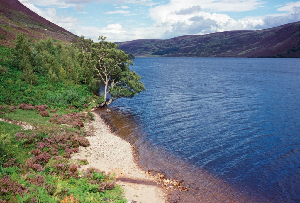
Loch Muick. Credit: Alex Roddie
9. NO295844: After just under 3km alongside the loch, reach a boat house and landing stage. Take a path veering right (SE) along the end of the loch. Cross a footbridge, then make a short climb uphill to meet another track. Follow it N back to the Spittal of Glenmuick.
Further information
PUBLIC TRANSPORT: None to start, but bus 201 runs regularly from Aberdeen to Ballater
TOURIST INFORMATION: visitballater.com