
Roger Butler makes use of the train to explore the empty hills – Wernygeufron Hill and Beacon Hill – west of Offa’s Dyke.
If Offa’s Dyke was part of a theme park it would be an eye-catching roller coaster but those incessant ups and downs continue to rumble and roll once you’ve crossed the Welsh border down by the River Teme near Knighton. Here, fingers of high moorland point west towards little-known hills in deepest Powys.
This long linear romp takes advantage of a couple of stops on the Heart of Wales Line and glides along tongue-twisting Wernygeufron Hill before following Glyndŵr’s Way through deep heather to the top of Beacon Hill. This broad summit, with a rim of crumbly crags, forms the centre of a sprawling upland massif criss-crossed by old drover’s tracks, some of which passed a former farmstead with the evocative name of New Invention. Something special must have happened there. The route then turns south above a steep valley, past the source of the River Lugg, which eventually leads down to the simple station at Llanbister Road. Stick your arm out to make sure the train stops for a swift return to Knucklas!
Beacon Hill: route description
Start: Knucklas, grid ref SO253742 | Finish: Llanbister Road station, grid ref SO174716 | Map: OS Explorer 201 and 214 (1:25k); OS Landranger 148 (1:50k) | Distance: 18.5km / 11.5 miles | Ascent: 585m / 1920 feet | Duration: 7 hours
1. SO253742: From the centre of Knucklas – the name derives from the Welsh for ‘green hillock’ – walk towards the spectacular railway viaduct and fork R by the Castle Inn. Walk down lane, turn R over the bridge and immediately fork L onto a narrow no through lane by the phone box. This runs next to the railway and by a sharp bend a path on R, in trees, leads up and over the old earthworks of Knucklas Castle. (The path is part of the waymarked Heart of Wales Line Trail). The castle was built in the early 13th century and included a square stone keep with four towers before it was ransacked by rebel Owain Glyndŵr in 1402. Drop north-west to track, turn L and then R and now keep ahead to the next lane. Turn R, walk around hairpin bend and go R again at next junction.
Looking east from Goytre Hill with the west-facing slopes below Offa’s Dyke in the distance. Credit: Roger Butler
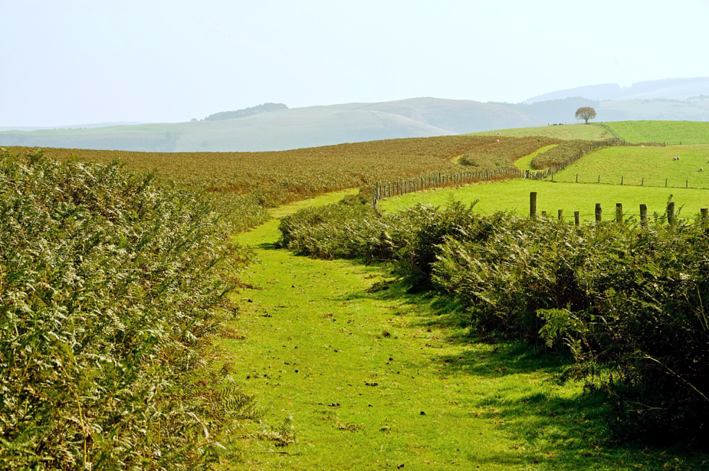
2. SO244757: After 400m go sharp L onto signed bridleway in trees, soon climbing steeply uphill. Pass through two gates, keep uphill through open pasture and continue towards prominent clump of pines. Cross Goytre Hill and walk west to gate with bracken-clad hillside beyond. You are now on a long finger of Open Access land – continue west, with fence on L, and follow the broad ridge over Wernygeufron Hill, with scatterings of gorse and occasional pools. Keep ahead on the grass path for 3km to a forestry plantation on L at a junction of tracks.
Beacon Hill (centre) and the northern slopes of Pool Hill (left) seen from Wernygeufron Hill. Credit: Roger Butler
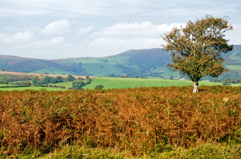
3. SO191748: Ignore tracks leading south into the trees and continue for 200m to cross the line of an ancient dyke known as the Short Ditch. Join the track, now walking along Glyndŵr’s Way, and keep ahead for 1.5km. Leave Glyndŵr’s Way and fork R on path around the head of the long quiet valley of the Lawn Brook. Bear R below Beacon Hill and continue east to the edge of the steep heathery escarpment at Fron Rocks, with unexpected rocky outcrops and views back to Wernygeufron Hill, with Offa’s Dyke running along the horizon beyond.

Panorama looking east over Wernygeufron Hill from above Cwm-lago, with the crest of Offa’s Dyke on the far horizon. Credit: Roger Butler
4. SO187766: Retrace your steps for 1km and then veer R on a track to the trig pillar on Beacon Hill, with ancient tumulus nearby. The swathes of moorland up here belong to the Crown Estate. From the top, walk south-west (no path) to a crossroads of tracks/bridleways and continue south, over another track, to meet Glyndŵr’s Way again. Turn L for 650m to another crossroads of tracks.
5. SO176759: Turn R on a bridleway, with the low hump of Pool Hill ahead. This passes through a maze of grouse moor management – there are so many tracks around Beacon Hill you can often veer off-piste. Pass the source of the River Lugg and continue south with an empty valley on L. Descend to gate and track as you finally leave Open Access land and turn R at next track to pass large new barn.

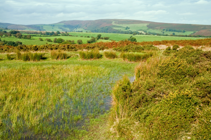
The upland commons around Beacon Hill are important habitats for moorland birds and rare invertebrates. Credit: Roger Butler
6. SO171728: Turn R at road and then turn immediately L onto lane. Walk around a couple of bends and take second path on L to dip down to the small station at Llanbister Road.
7. SO174716: It’s worth checking the timetables at the start of the day, but there is normally a train at the end of the afternoon and, despite the isolated location, real-time information is provided. But do remember to raise your hand – you might well be the only person waiting for the ten-minute ride to Knucklas! The train passes through a short tunnel and crosses the 13-arch viaduct as it arrives at the station, just south of the village centre.
Further information
Public transport: Knucklas and Llanbister Road stations are on the Heart of Wales Line; also bus connections to Knucklas from nearby Knighton
Tourist Information: Offa’s Dyke Centre, Knighton – 01547 528753
Walk more routes in Wales, as mapped by our experts.


