

Stefan Durkacz takes the train into the heart of the Central Highlands to the Corrour Corbetts.
Scotland’s West Highland Line is a boon for adventure-seekers. Without it, much of the vast country around Rannoch Moor would be hard to access. Corrour station especially is very far from the road network. It’s a welcoming oasis amidst the moors and mountains and a great place to start and finish your adventures. Refreshments can be had at the Corrour Station Teahouse, and there’s a youth hostel nearby at Loch Ossian. The options for expeditions are almost endless. The route described here squeezes a lot into a day and a half, or one long day for the super-fit in summer: the two Corrour Corbetts, a brace of bothies and some fine walking on the long-distance rights of way that traverse the area.
The landscape varies from birch-clad glens and river gorges to lonely summits. Glas Bheinn commands a particularly jaw-dropping panorama, from the Nevis range and Grey Corries to the north to the Glencoe peaks in the south. This route can be walked anti-clockwise (as described here) or clockwise. An overnight stop at, respectively, Loch Chiarain or Staoineag bothies should enable you to return to Corrour in time for the lunchtime train. There are a couple of potentially serious river crossings (the Abhainn Rath at Staoineag and the Loch Chiarain outflow) so this route is best not attempted during or immediately after very wet weather.
Corrour Corbetts: route description
Start/Finish: NN 356 664 Corrour station | Maps: OS 1:50,000 Landranger sheet 41 Ben Nevis; OS 1:25,000 Explorer sheet 385 Rannoch Moor & Ben Alder and sheet 392 Ben Nevis & Fort William | Distance: 28.5km/17.5 miles Ascent: 1249m/4098ft | Duration: 10-12 hours or overnight. Bothies at Staoineag (NN 296 678) and Loch Chiarain (NN 289 634) maintained by the Mountain Bothies Association.
1. N 356 664: At the north end of the platform turn L. Cross the track to a locked gate and step over a low wooden fence beside it. Turn R on the path shadowing the railway line and signposted for Fort William, Kinlochleven and Spean Bridge. In roughly 600m a path branches L towards An Diollaid and Leum Uilleum. Ignore this, continuing NW along the path by the railway. A little over 1km further on, the path crosses the Allt Lùib Ruairidh by a footbridge right next to the railway bridge and joins a broad track serving a mini hydro scheme. Turn L and follow the track downhill to Loch Treig.

By the Abhainn Rath. Credit: Stefan Durkacz
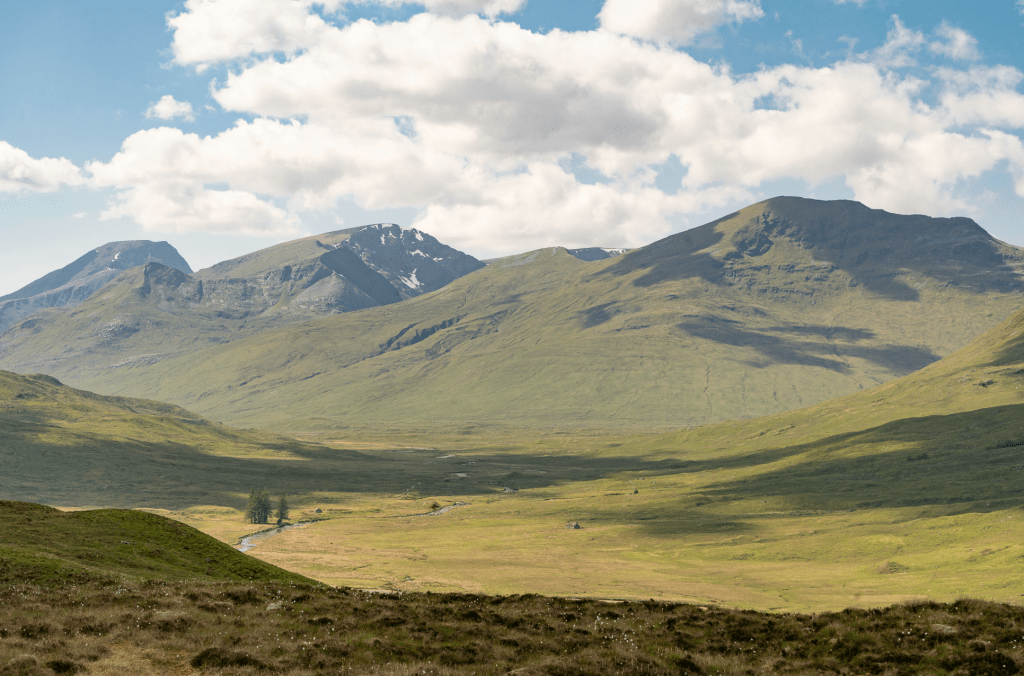
2. NN 328 690: At a junction just above the loch, turn L and cross the Allt Crunachgan by a bridge where the burn plunges into a deep pool. Roughly ¾km further on, just beyond the bridge across the Allt Iolairean, a path signed for Kinlochleven branches L. Ignore this, keeping on the path above Loch Treig. Eventually Craiguineach Lodge comes into view. Abandoned in the 1980s, the building is overshadowed by the birch-clad craggy prow of Creag Ghuanach, celebrated as a rock-climbing venue in a poem stuck to the wall in nearby Staoineag bothy. Cross the gorge of the Abhainn Rath by a long wooden footbridge.
Staoineag bothy. Credit: Stefan Durkacz
3. NN 309 689: At the far side of the bridge turn L on the path signposted for Fort William. Follow the path upstream alongside the Abhainn Rath. The glen broadens out then swings sharply R and narrows again, the path etched across the slope above the river. Soon, Staoineag appears on the opposite bank. Opposite the bothy, cross the river by stepping stones and climb a steep bank to reach it. Staoineag is in a magnificent location but suffers somewhat from overuse with a lack of furniture and sleeping platforms, decrepit and smoky fireplaces and a lot of graffiti. That said, it’s solid and dry with floor boards and wood panelling providing insulation.
Ben Nevis, Aonach Beag and Sgurr Choinnich Mor from Ceann Caol na Glas-bheinne. Credit: Stefan Durkacz
4. NN 296 678: You’re now deep in the mountains, with Ben Nevis and Aonach Beag appearing to the W beyond the Glen Nevis watershed. Continue upstream on the S side of the Abhainn Rath for around 750m then bear L alongside the Allt Gleann na Giubhsachan. After 600m cross the burn and look for a faint Landrover track climbing up the hillside. This eases the climb onto the Ceann Caol na Glas-bheinne, winding up and around the bumpy, boggy lower slopes before bearing SW along the crest. The track continues for a good distance along the broad ridge towards Glas Bheinn, albeit faint and easily lost in places. Pause at rush-fringed Lochan a’ Chuirn Dheirg for a glorious view northwards to the Grey Corries before the final climb to Glas Bheinn (792m), the summit marked by a tidy cairn.
Blackwater Reservoir from Glas Bheinn. Credit: Stefan Durkacz
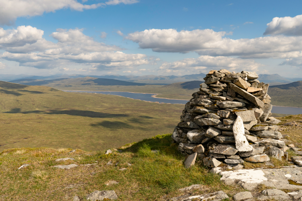
5. NN 259 641: Descend S, with the kilometre-long Blackwater dam below you. The vast reservoir stretches for 17km eastwards. The dam was constructed in the early 1900s to supply hydroelectric power for aluminium smelting. There’s also a sinuous, side-on view of Buachaille Etive Mòr – look for the jutting fang of the Crowberry Tower on the east face of Stob Dearg. Lower down, the slope steepens. Turn a few outcrops to reach the path from Kinlochleven. Head E for 3.5km to the beautifully situated bothy at Loch Chiarain. The upper rooms are habitable with a big sleeping platform and fireplaces. This bothy receives far fewer visitors than Staoineag.
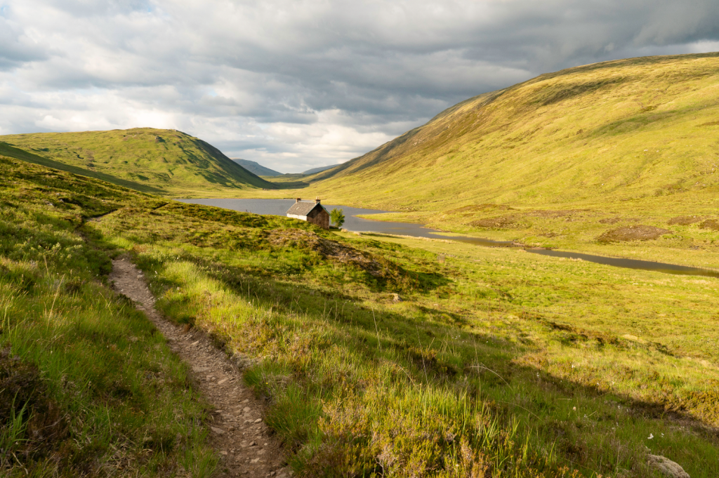
Approaching Loch Chiarain bothy. Credit: Stefan Durkacz
6. NN 288 634: Cross the loch’s outflow by stepping stones and climb E to Beinn a’ Bhric. Reach the broad ridge above Coir’ a’ Bhric Mòr and follow a rough Landrover track NE along the crest, passing to the L of Beinn a’ Bhric’s summit after about 1km. Carry on NE a little further, descending slightly before leaving the track and heading SE for roughly 350m to pick up another track. Follow this SE for another 300m or so; where it starts to descend, leave it and strike E up broad slopes to reach the tall, well-built cairn marking the summit of Leum Uilleum, William’s Leap (909m).
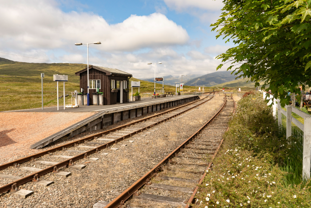
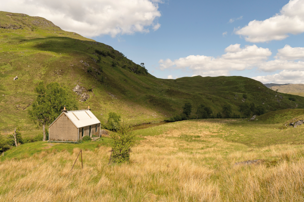
Corrour Station. Credit: Stefan Durkacz
7. NN 331 641: From the summit bear NE keeping the steep rim of Coir’ a Bhric Beag on your L. The descent soon steepens. Follow the rough hillwalker’s path as it winds its way down the outcropped crest of Sròn a’ Lagain Ghairbh. As the ridge merges into moorland the going becomes boggy and the path easily lost in places. However, Corrour station (and its welcoming teahouse) provide a target that is impossible to miss except in the worst visibility.
Further information
Public transport: Corrour station is served by Scotrail trains between Glasgow Queen Street, Fort William and Mallaig and the Caledonian Sleeper between London Euston and Fort William. Always check timetables and live updates when planning your trip and allow ample time to ensure you catch your return train. No car access to Corrour. See www.scotrail.co.uk for tickets, timetables and live updates.
Tourist information: Fort William VisitScotland iCentre (Tel: 01397 701801)
Walk more routes in Scotland, as mapped by our experts.


